News
‹ back to weather news
News
-
Sydney's wettest August day in almost two decades
Anthony Sharwood, 21 August 2025Sydney has endured its wettest day of a very soggy year, after 82.4mm of rain was recorded in the 24 hours to 9am Thursday – more than the entire monthly average rainfall for August in a day.
The unseasonable deluge, in what is typically the fourth-driest month of year, meant that:
- It was Sydney’s wettest August day since 2007.
- It was Sydney’s wettest day of 2025 to date.
- It was Sydney’s wettest day since June 2, 2024, when 142.6mm fell.
- Sydney has now more than quadrupled its average August rainfall of 79.9mm, with a running monthly total of 345.2mm to 9am Thursday.
- To 9am Thursday, Sydney has received 1326.4mm of rain this year, with a running total which is already more than 100mm above the annual average in records that go back to 1858.
Meanwhile steady rain continues to fall on Thursday and looks likely to persist until at least Friday. And it’s not just Sydney copping a drenching. Notable rainfall totals across NSW in the 24 hours to 9am Thursday included:
- 149.4mm at Lake Cathie, about 15 minutes south of Port Macquarie on the Mid North Coast. At least seven weather stations in the area topped 100mm.
- 90.2mm at Evans Head on the NSW North Coast
- 89mm at Bellambi, the main weather station in Wollongong just south of Sydney.
- 78mm at Robertson on the Illawarra escarpment, just southwest of Wollongong.
- 60mm or more at numerous locations near Coffs Harbour
- 55.2mm at Duri near Tamworth, one of the heaviest falls west of the Great Dividing Range.
As indicated by the heavy rain near Tamworth (where the average August rainfall is just under 40mm), this event is remarkable not just for the heavy August rainfall on the coast and nearby ranges, but for how far the heavy rain has pushed inland.
Indeed the only major and moderate flood warnings currently in place on Thursday morning for NSW are for the Namoi River (major) and Peel River (moderate), which both flow through the North West Slopes and Plains forecast district, west of the Great Divide.
However numerous flood watches and minor flood warnings are in place statewide, including for the Nepean and other rivers near Sydney. Please check the ongoing flood warning status at the Weatherzone warnings page, and for more detailed information on road closures, check the NSW SES site.
Why is it raining so much in NSW?
According to Weatherzone meteorologist Jess Miskelly, a slow-moving high pressure system centred over the Tasman Sea east of Tasmania is dragging moist air towards the NSW coastline which is interacting with a coastal trough.
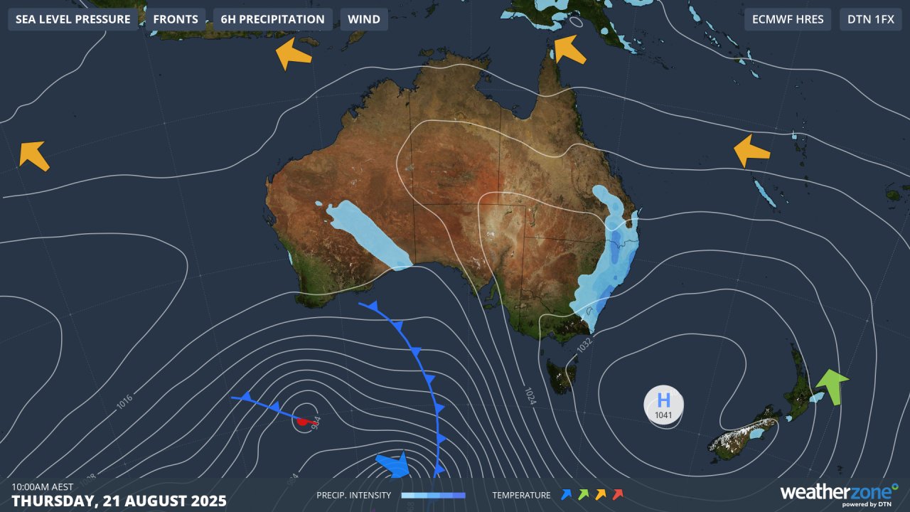
Image: Synoptic chart for Thursday, August 21, 2025, showing air circulating anti-clockwise around the high.
The high is located further south than usual for this late in winter, creating a persistent onshore flow more commonly seen in NSW from late summer through to early winter – historically Sydney’s wettest time of year.
Above-average sea surface temperatures are also playing their part in enhancing the amount of available atmospheric moisture through evaporation.
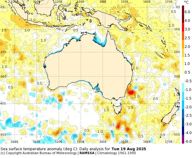
Image: Sea surface temperature anomalies showing an area of very warm water (around three degrees above average for this time of year) near Sydney. Source: BoM.
A drying trend will commence in NSW from the latter half of the weekend onwards, as the Tasman Sea high moves east towards New Zealand and westerly winds more typical of late August set in over southeastern Australia.
- Other news
- Fri 22 Aug 2025 Sydney on verge of third wettest August on record
- Fri 22 Aug 2025 Hurricane Katrina, 20 years on
- Fri 22 Aug 2025 Burst of fall temperatures to descend through US this weekend, next week
- Thu 21 Aug 2025 The key factor behind the relentless NSW rain
- Wed 20 Aug 2025 Relentless NSW rain to intensify before drying trend sets in