News
‹ back to weather news
News
-
Burst of fall temperatures to descend through US this weekend, next week
John Baranick, 22 August 2025It’s been hot this summer, especially on the eastern and western ends of the U.S. Temperatures have routinely been above normal. But summer is almost over, and according to the meteorological calendar, that will occur at the start of September. Fall brings with it declining sunlight and average temperatures. The U.S. will get a quick burst of that coming up this weekend and into next week.
The weather pattern has been all over the place this summer, but one thing has been true, the bursts of milder air have been shorter for a lot of the country than the hot and humid times, especially for those west of the Rockies and east of the Mississippi River. Due to more active rainfall and fronts from Canada, those in the Plains and even parts of the Upper Midwest, have seen more ups and downs that have averaged out to a nearly average summer.
For those east of the Rockies though, this weather pattern is about to change. An upper-level trough of low pressure was moving through western Canada earlier this week. It will move into the U.S. Great Lakes region over the weekend and deepen significantly, only moving slowly eastward next week.
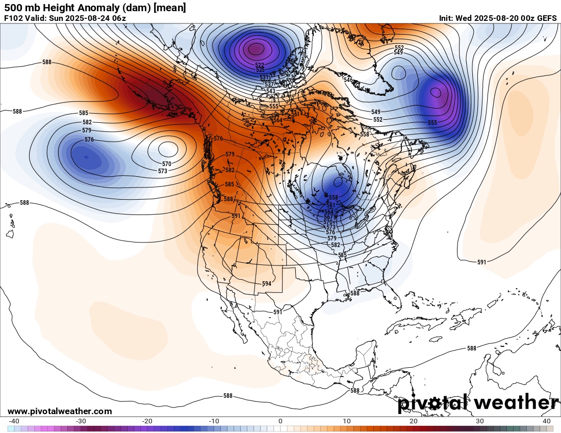
Image: An upper level trough (in blue) will build across the Great Lakes and send temperatures crashing east of the Rockies. Source: Courtesy Pivotal Weather.
We are likely to see another burst of energy maintain that trough later next week as well. These troughs can bring through big storm systems, like the one that is developing in the Canadian Prairies. And with the counter-clockwise winds around the center, this trough will bring northwest winds and push a strong cold front through the U.S. That front will get into the Northern Plains on Thursday, August 21 before pushing through the vast majority of the country east of the Rockies over the weekend. The front is then forecast to stall from the Southern Plains through the Gulf Coast.
Cool, northern Canadian air will descend into the U.S. and give folks their first taste of the fall season. Temperatures will fall some 20-30 degrees Fahrenheit behind the front, unusual during the summertime. Areas in the Northern Plains that have highs in the 90s F will fall into the upper 60s F while those across the South will go from the lower 90s F to the upper 70s and lower 80s F.
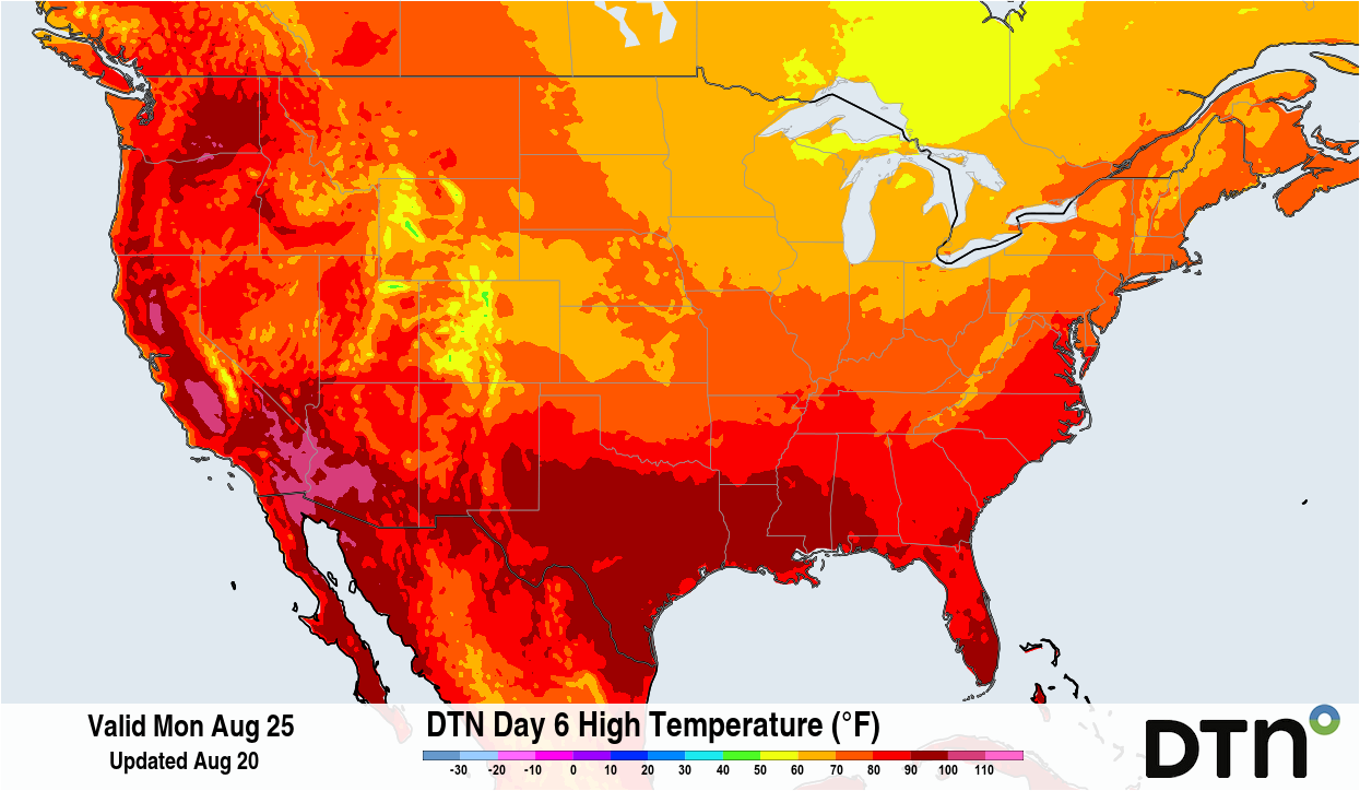
Image: High temperatures at the peak of the event (Monday, August 25) will only be in the 60s and 70s F for the vast majority of the country east of the Rockies. Source: DTN.
Overnight temperatures will also be chilly with a lot of 40s and 50s F across the North and 50s and 60s F across the South. There is even a slight risk of frost in eastern North Dakota and northwest Minnesota on Sunday and Monday morning, August 24-25, although more than likely, temperatures will drop down into the upper 30s and lower 40s F.
The humidity will also be noticeably drier as dew points plunge from the 60s and 70s F into the 40s and 50s F. The combination of cool and crisp air will cause a noticeable drop in temperatures that should last this weekend into a good portion of next week. Areas south of the front will not find the significant relief but could see increased rainfall that could help keep temperatures down in the afternoons.
Eventually, temperatures will moderate and the humidity will start to increase again later in the week, but the oppressive summer heat is not forecast to return for the rest of August. It will get harder and harder to do as we flip the calendar over to September, but will not be impossible.
The September forecast is calling for above-normal temperatures to return. But we must remember that our “normal” temperatures will be falling throughout the month, especially toward the end of September and especially in October.
- Other news
- Fri 22 Aug 2025 Sydney on verge of third wettest August on record
- Fri 22 Aug 2025 Hurricane Katrina, 20 years on
- Thu 21 Aug 2025 The key factor behind the relentless NSW rain
- Thu 21 Aug 2025 Sydney's wettest August day in almost two decades
- Wed 20 Aug 2025 Relentless NSW rain to intensify before drying trend sets in