News
‹ back to weather news
News
-
Record May rain hits western Sydney as NSW soaking continues
Ben Domensino, 23 May 2025Heavy rain continued across a broad area of eastern and southern NSW over the last 24 hours, with parts of western Sydney receiving their heaviest single day of May rain on record.
A slow-moving low pressure trough being fed by moisture-laden air from the Tasman Sea caused widespread rain over NSW on Thursday into Friday morning. This latest bout of rain continues a week-long drenching that started last weekend and has brought record-breaking rain and floods over the past 5 days.
In the 24 hours ending at 9am AEST on Friday, May 23, falls of 100 to 150mm were recorded over a broad area of the NSW coast and ranges stretching from the Port Macquarie region down to about Moruya. There were even a few places that picked up more than 200 mm in this period. Some of the standout totals included:
- 233 mm at Macquarie Pass (Illawarra)
- 181 mm at Richmond Airport (Western Sydney)
- 157 mm in Woy Woy (Central Coast)
- 157 mm at Darkes Forest (near Wollongong)
- 154 mm at Lake Macquarie (Hunter)
- 146 mm at Gosford (Central Coast)
- 131 mm at Faulconbridge (Blue Mountains)
- 120 mm at Terrey Hills (Sydney)
- 102 mm at Taree (Mid North Coast)
Richmond Airport’s 181.4mm of rain in the 24 hours to 9am on Thursday was the airport’s wettest May day on record. Penrith (115.6 mm), Terrey Hills (120.2 mm), Lake Macquarie (153.6 mm) also set new May records for these sites. Sydney’s Observatory Hill collected 72mm of rain, its wettest May day in 24 years.
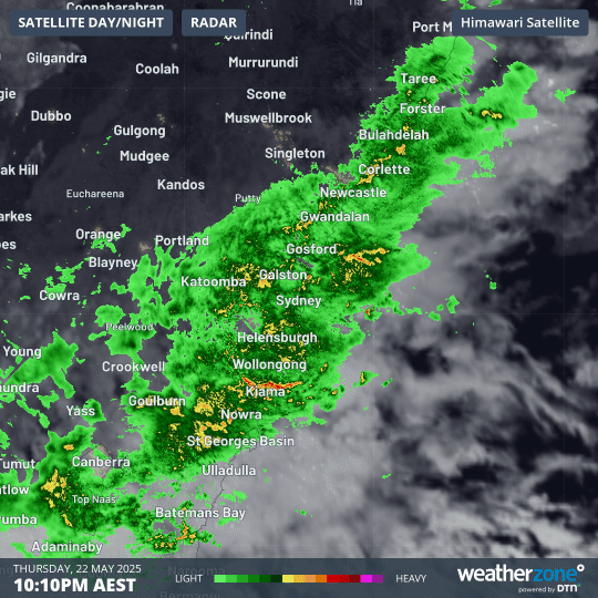
Image: Composite radar and satellite showing relentless rain over central eastern NSW on Thursday night and Friday morning.
Colossal weekly rainfall totals
The rain from the last 24 hours has pushed the running weekly accumulations well above half a metre in some areas.
Comboyne Public School, located southwest of Port Macquarie, registered 704 mm of rain in the 4 days ending at 9am on Friday.
Other huge 4-day rainfall totals up to 9am on Friday include 686 mm at Mount Seaview and 605 mm at Taree Airport. Prior to this week, Taree Airport had never registered more than 407 mm in the whole month of May, with data stretching back to 1882.
Floods spread south with recent rain
The most recent round of heavy rain has caused rivers to bulge across parts of eastern NSW, leading to new flooding in some areas and exacerbating existing flooding in others.
Moderate to major flooding continues in a number of rivers across the Hunter and Mid North Coast, despite the rain clearing most of these regions overnight.
Near Sydney, major flooding could develop in Tuggerah Lake on the Central Coast overnight Friday into Saturday. Minor to moderate flooding should occur along the Colo River on Friday, and minor flood warnings are also in place for parts of the Hawkesbury and Georges Rivers.
Flood watches and warnings also extend south through parts of the Illawarra and South Coast regions.
Where is the rain heading next?
Rain has already cleared from flood-weary areas of northeastern NSW and will continue contracting towards southeast NSW into Friday afternoon and night. Dry weather will then return across the state from Saturday as the rain-bearing trough that has plagued the state all week finally moves out over the Tasman Sea.
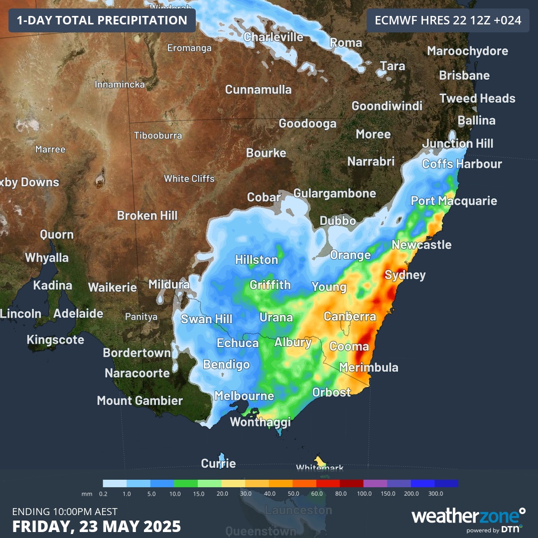
Image: Forecast accumulated rain during the 24 hours ending at 10pm AEST on Friday.
Another cold front will cause showers to return to parts of NSW on Monday and Tuesday next week, falling as rain and snow, although this precipitation will mostly stay west of the Great Dividing Range.
Why has this week been so wet?
As we pointed out earlier this week, the weather system responsible for this week’s rain had several unique characteristics that resulted in unusually long-lasting heavy rainfall across a large area of NSW:
- A broad pool of cold upper-level air has been lingering over NSW since the start of this week. This cold air aloft provided what meteorologists refer to as upper-level forcing, which deepened a low pressure trough near the surface and enhanced convection (clouds forming in rising air) over eastern NSW.
- This low pressure trough hardly moved over the space of four days, which caused heavy rain to remain focussed on the Hunter and Mid North Coast regions for a prolonged period.
- The onshore winds feeding the rain this week have extended through a deep layer of the atmosphere, which provided copious fuel for rain-bearing clouds.
- Above average sea surface temperatures in the Tasman Sea provided extra atmospheric moisture, increasing how much water was in the sky to fall as rain.
- The landscape across eastern NSW was already wet before this week’s rain arrived, which exacerbated the extent and severity of flooding.
Be sure to check the latest weather and flood warnings and road closures in your area for the most up-to-date information.
- Other news
- Fri 23 May 2025 NSW floodwaters visible from space as rain slowly clears
- Thu 22 May 2025 Unusual late May deluge for northern Australia
- Thu 22 May 2025 Why is NSW so wet and when will the rain stop?
- Wed 21 May 2025 Powerful polar blast roaring towards Australia
- Wed 21 May 2025 Historic flooding as eastern NSW deluge continues