News
‹ back to weather news
News
-
Warm blob of water increasing tropical cyclone potential near northern Australia
Ben Domensino, 13 November 2025Sea surface temperatures exceeding 31°C off the coast of northern Australia are increasing the likelihood of early-season tropical cyclone activity, with hints of the season’s first tropical cyclone coming as early as next week.
Tropical cyclones require sea surface temperature of 26.5°C or warmer to develop, with higher ocean temperatures providing more energy for cyclones to gain strength.
Water temperatures to the north of Australia are currently sitting around 1-2°C above average for this time of year, with sea surface temperatures as high as 31°C to the west of the Top End and north of the Kimberley.
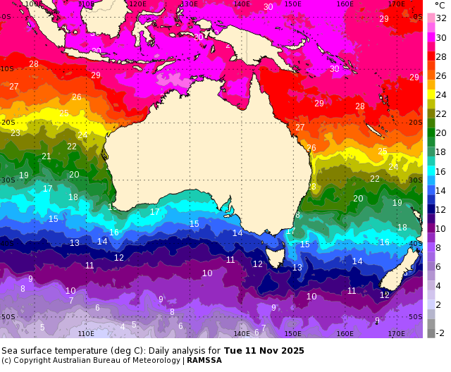
Image: Sea surface temperatures near Australia on November 11. Source: Bureau of Meteorology
The blob of warm water to the northwest of Darwin ranks in the top 10 percent of historical records for this time of year, meaning the ocean is primed to support tropical cyclone development in the coming weeks.
Some forecast models suggest that a tropical cyclone could develop over this area of warm water next week. The Bureau of Meteorology’s official 7-day tropical cyclone forecast gives a low chance of a cyclone forming as early as Tuesday.
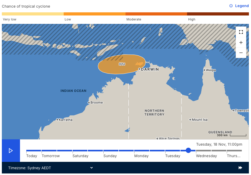
Image: 7-day tropical cyclone forecast from the Bureau of Meteorology.
Modelling from the European Centre for Medium Range Weather Forecasts (ECMWF) also hints at growing tropical cyclone potential over the pool of warm water towards the end of next week.
The map below shows that the ECMWF model is predicting a 20 to 30% chance of a tropical cyclone activity west of the Top End on Friday, November 21.
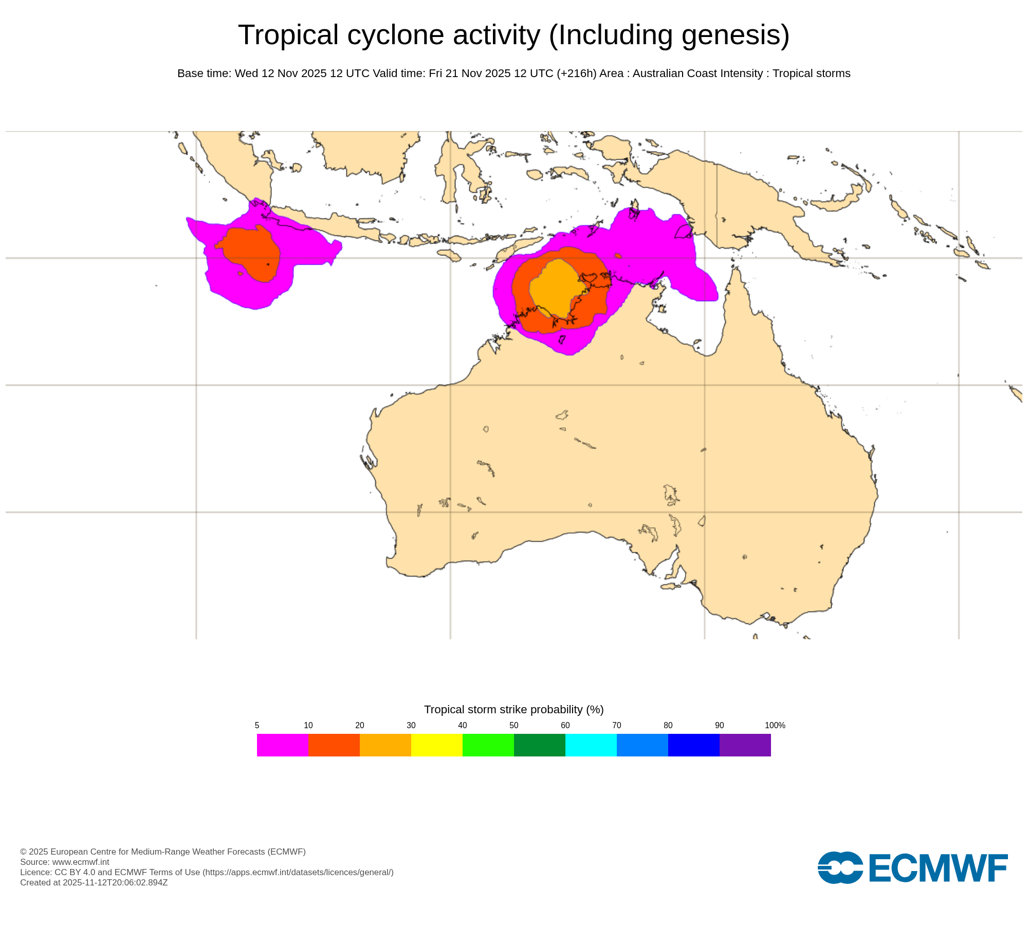
Image: Tropical cyclone potential near Australia late next week. The colours on the map represent the likelihood that a tropical cyclone will pass within 300 km of that location within 48 hours of 11pm AEDT on Friday, November 21. Source: ECMWF
Another factor that adds weight to the increasing potential for early-season tropical cyclone activity next week will be a tropical atmospheric wave passing to the north of Australia. This wave, called the Madden-Julian Oscillation (MJO), should cause an increase of cloud and thunderstorm activity near northern Australia next week. This enhanced storminess can help create low pressure systems that can deepen to become tropical cyclones.
While there is still only a low chance of a tropical cyclone forming near Australia next week, anyone living in northern Australia should keep a close eye on the latest forecasts and warnings.
The Australian tropical cyclone season runs from November 1 to April 30 and the first tropical cyclone to form this year will be named Fina.
- Other news
- Wed 12 Nov 2025 Australia on 'Aurora Alert' with severe geomagnetic storm in progress
- Wed 12 Nov 2025 Coldest November morning on record for parts of SE Australia
- Tue 11 Nov 2025 Late-spring chill spreading across southeastern Australia
- Mon 10 Nov 2025 Typhoon Fung-Wong crosses Philippines; Taiwan next in line
- Mon 10 Nov 2025 Snow-vember: Yet more Aussie snow coming just three weeks before summer