News
‹ back to weather news
News
-
October on track to beat hottest November on record for Sydney
Ben Domensino, 20 October 2025Sydney’s days have been so hot this October that the city is currently on track to break the average maximum temperature record for November.
Frequent westerly winds, a lack of cloud and rain, and repetitive bouts of hot air from inland NSW have caused Sydney’s daytime temperatures to run about 4 to 5°C above average so far this month.
Based on current forecasts, which include highs of 33°C on Monday and 38°C on Wednesday this week, Sydney’s average maximum temperature for October could come in at just above 27.1°C. This would be roughly 5°C above average for this time of year.
If this happens, it will not only beat the previous October record of 26.2°C from 1988, but it will also trump the November record of 27.0°C from 2019. No spring month has ever been this hot in Sydney’s meteorological history, which dates back to 1859.
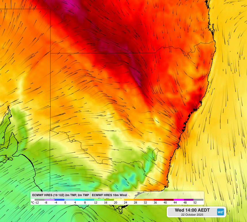
Image: Forecast air temperature and wind at 2pm AEDT on Wednesday, October 22, 2025, showing warm northwesterly winds flowing towards Sydney.
Why is Sydney so hot and dry this month?
In a typical October, Sydney would experience periods of warm and dry weather interspersed with bursts of mild and stormy weather. This month, however, the dry and hot days have been plentiful, while cooler and wetter days have been scarce.
One of the main reasons for Sydney’s extremely warm weather this month has been the ongoing influence of a negative Southern Annular Mode (SAM) in the Southern Hemisphere.
A negative SAM occurs when the belt of westerly winds that flows around Antarctica becomes displaced to the north. Because this westerly wind belt passes between Australia and Antarctica, a negative SAM during spring typically causes westerly winds to become more prominent over southern and eastern Australia. For eastern NSW, a negative SAM in spring promotes hot and dry westerlies.
The SAM has been in a negative phase for most of September and October in response to a sudden stratospheric warming (SSW) event that occurred high above Antarctica over the past several weeks.
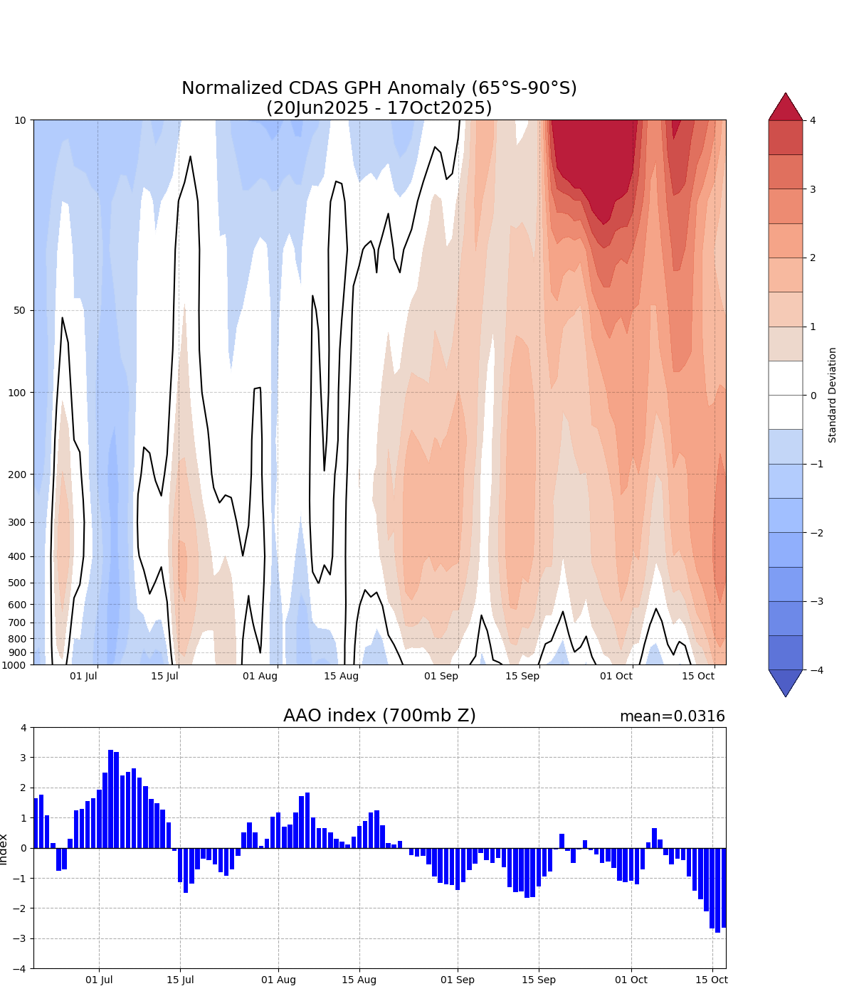
Image: Geopotential height anomalies for the polar region south of 65°S over the past four months. The red shading on the top graph shows a period of sudden stratospheric warming (SSW) in September and October. The blue bar graph at the bottom shows that this SSW has been associated with a predominantly negative southern annular mode (SAM) this spring. Source: NOAA
This month’s prolonged and strong negative SAM is likely a big reason for Sydney’s relentless run of warm and dry days.
Climate change is also likely playing a part, with Sydney’s springtime maximum temperatures having increased by close to 0.7°C since 1910.
- Other news
- Sun 19 Oct 2025 Severe storm aftermath in eastern Australia
- Sat 18 Oct 2025 Brace yourself Southeast Queensland for severe thunderstorms this afternoon and evening.
- Fri 17 Oct 2025 Severe storms pummel NSW with 400,000 lightning strikes in five hours
- Fri 17 Oct 2025 What is a supercell thunderstorm?
- Fri 17 Oct 2025 Record October heat possible in at least three states