News
‹ back to weather news
News
-
Severe storm aftermath in eastern Australia
Craig Mitchell, 19 October 2025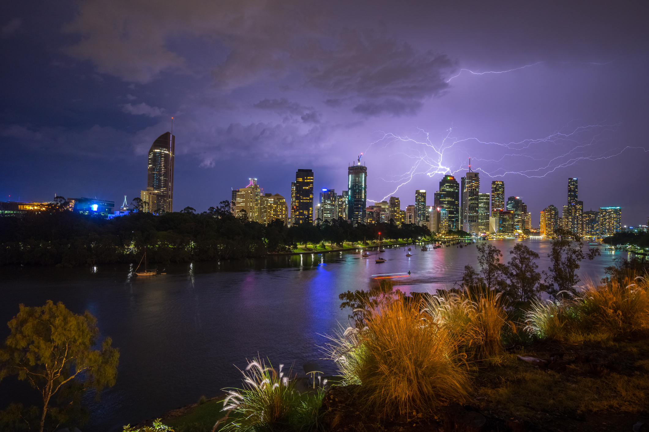
Image: Archive image of a thunderstorm and lightning over Brisbane City. iStock:Credit:EyeEm Mobile GmbH
Thunderstorms developed on a southerly change and trough moving north across northeast NSW and into southeast Qld during Saturday afternoon and early evening.
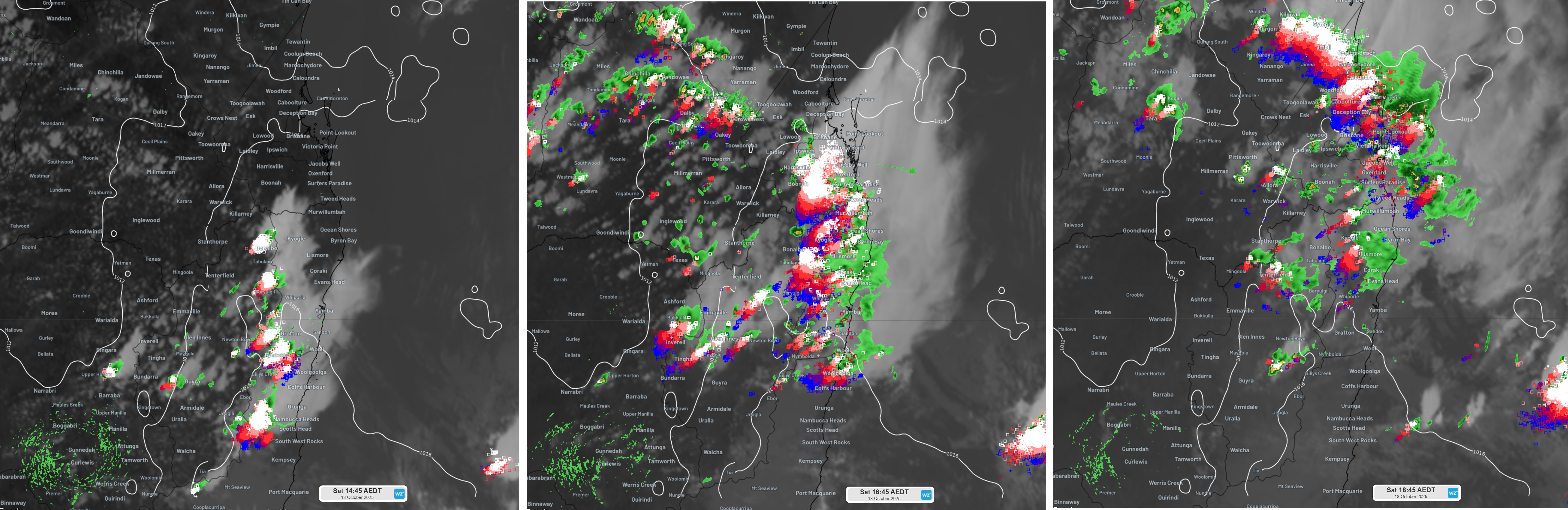
Image: Infrared satellite images with superimposed radar (green-yellow shading) and lightning strikes (blue-red boxes) for 2:45pm (left), 4:45pm (middle), and 6:45pm (right) EDST.
Reports came flooding in on social media of hail, strong winds and intense rain as severe thunderstorms developed inland from the north NSW coast mid-afternoon and then proceeded across southeast Queensland later in the afternoon before finally weakening and contracting off the Wide Bay coast mid-evening.
Images of golf ball sized hail were posted from Samford (Qld) along with video of small to medium sized hail covering property yards across southeast Queensland from places such as Bellmere, Narangba, Jimboomba, and Moggil to name a few. Very strong winds were also captured on video as a storm passed over Jimboomba.
The path of individual thunderstorms can be seen from detected lightning strikes during Saturday afternoon.
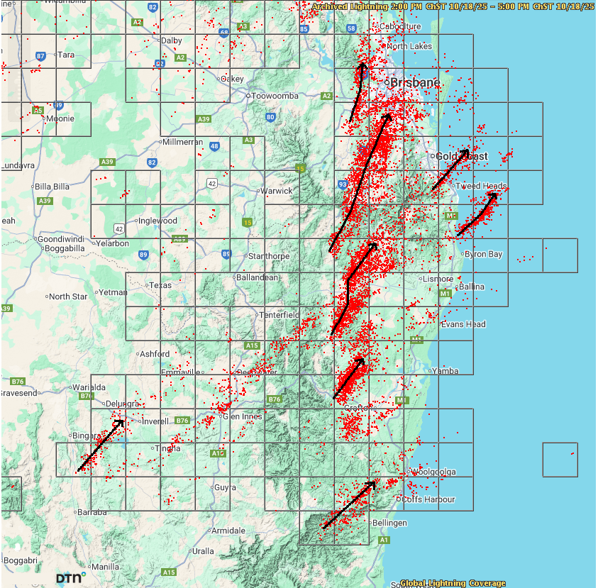
Image: Lightning strikes (red dots) captured by DTN's Global Lightning Network between 2pm and 5pm EDST. Black arrows show the path of stronger individual thunderstorm cells.
Overall, the total lightning strike count from DTN's Global Lightning Network for this event was near to 272,000.
The strongest observed wind gusts within storms were reported in Queensland. The more notable wind gusts were (times reported in AEST):
Dalby (Qld) - 80km/h at 3:16pm
Amberley (Qld) - 80km/h at 4:09pm
Gayndah (Qld) - 70km/h at 5:30pm
The higher rainfall totals during this event were observed across more elevated areas through inland southeast Queensland with many centres under the path of stronger thunderstorm cells experiencing totals ranging between 25-30mm. For the Brisbane Metro and Gold Coast regions, rainfall totals were generally less than 10mm.
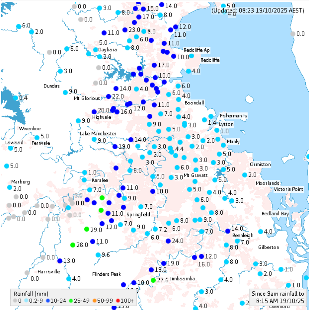
Image: 24-hour rainfall totals to 8:15am 19 October 2025. Source: Bureau of Meteorology
Saturday was a wild ride for many residents over northeast NSW and southeast Queensland. Thankfully, the weather pattern across the broader region today is more settled as gentler E/SE winds bring milder temperatures and a couple of lighter showers developing in the afternoon about the coast and neighbouring inland regions.
- Other news
- Sun 19 Oct 2025 Severe storm aftermath in eastern Australia
- Sat 18 Oct 2025 Brace yourself Southeast Queensland for severe thunderstorms this afternoon and evening.
- Fri 17 Oct 2025 Severe storms pummel NSW with 400,000 lightning strikes in five hours
- Fri 17 Oct 2025 What is a supercell thunderstorm?
- Fri 17 Oct 2025 Record October heat possible in at least three states