News
‹ back to weather news
News
-
Dangerous two days of damaging winds, thunderstorms as strong spring cold front lashes SE Australia
Anthony Sharwood, 19 September 2025Dynamic weather typical of early spring is buffeting central and eastern Australia this Friday, and it’s set to continue right through the weekend in some areas.
Severe weather warnings for damaging winds were issued for parts of NSW, Victoria and Tasmania on Friday morning, while gale warnings are in place for parts of coastal South Australia.
Two gusts of 80 km/h have already been recorded (nearly an hour apart) at Melbourne Airport on Friday morning before 10am, while kunanyi/Mt Wellington above Hobart recorded an overnight gust of 100 km/h.
Thunderstorms are also expected to break out across several states – with the possibility of severe storms from northern Victoria all the way up to southern Queensland on Friday afternoon – while snow, hail and icy winds will chill Tasmania, Victoria and southern NSW and the ACT by Saturday.
What’s causing the severe weather?
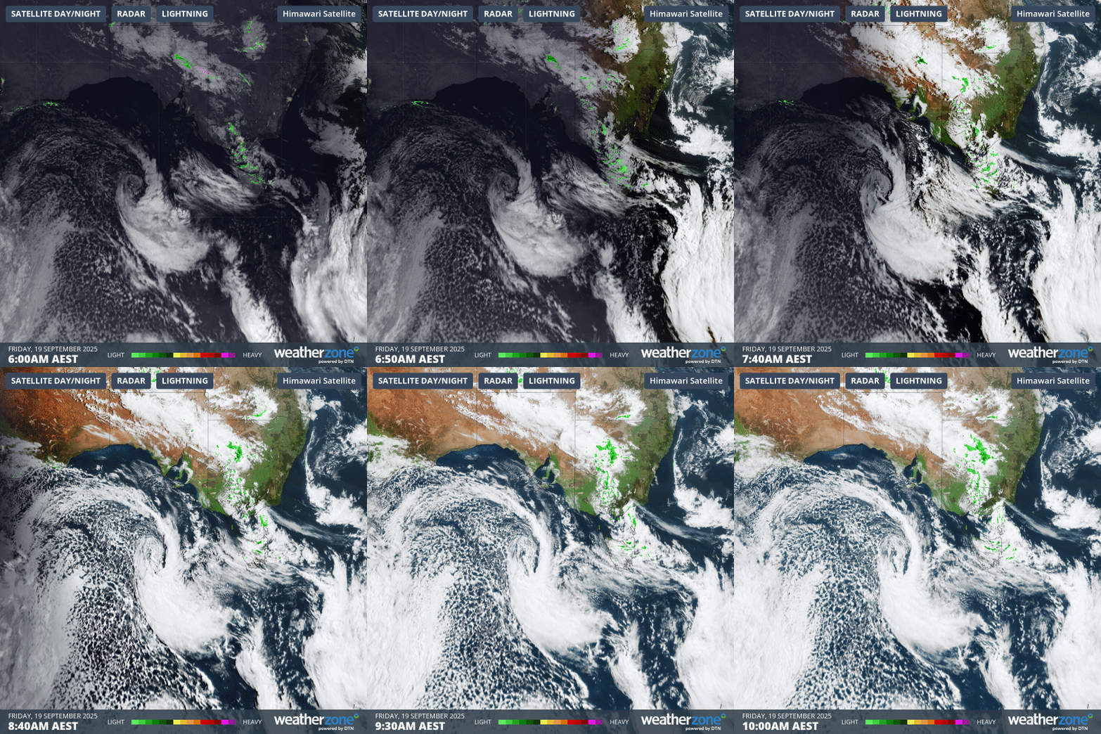
The engine driving this vigorous weather is an intense low pressure system, which on Friday morning was centred over waters south of the Great Australian Bight and west of Tasmania.

Image: Four-hour combined satellite and radar loop for SE Australia to 10am on Friday, September 19.
A cold front associated with the low pressure system is rapidly surging towards the mainland and Tasmania. Ahead of it, showers and storms have already formed along a trough extending from southern Victoria all the way to southern parts of the NT.
As mentioned, the severe thunderstorm potential increases on Friday afternoon as cold air clashes with warmer air. In Melbourne, showers should develop close to the 7:40pm opening bounce in the Geelong vs Hawthorn AFL Preliminary Final.
By Saturday morning, it will feel like winter has returned to southeastern Australia, with snow falling to as low as 1100m in the mainland high country and down to around 600m in Tasmania.
Severe weather will persist all weekend in Tasmania as a series of cold fronts lash the state, with a surge of particularly cold air for spring due on Monday. That cold air will also reach the southern mainland, dropping the snow level to around 800 metres.
Please check the latest weather warnings on the Weatherzone warnings page.
- Other news
- Thu 18 Sep 2025 Perth sets rainfall streak not seen in 18 years
- Wed 17 Sep 2025 Wettest September day in 37 years at Cairns Airport in unseasonable N Qld deluge
- Wed 17 Sep 2025 AFL Preliminary Finals weather: rain Friday, cold Saturday at the MCG
- Tue 16 Sep 2025 NSW shaken by three earthquakes in nine hours
- Tue 16 Sep 2025 Melbourne activates its 'rain shield', dodging moisture from the northwest

