News
‹ back to weather news
News
-
How did one of Chicago's rarest extreme weather events occur?
Maryam Al-Ansari, 18 May 2025On Friday 16th of May, a wall of dust spanning 160km swept across the state of Illinois and into Indiana. Winds around 110km/h whipped up loose farmland sediment, leading to dust plumes and road closures. Visibility dropping to zero metres, causing traffic accidents that resulted in at least 23 deaths.
A dust storm warning was issued hours before the event asking people to stay indoors unless necessary. This is only the second two dust storm warning to have ever be issued in Chicago. A dust storm of this magnitude is very rare, particularly this far north. So how did such a rare weather event happen?
Dust storms develop as a result of atmospheric microbursts picking up small particles and carrying them hundreds of kilometres away from their source. Such microbursts can arise from thunderstorms or frontal systems.
From midday Friday, severe thunderstorm activity began over central Illinois and persisted into the early evening. Due to mixing of the upper atmosphere’s dry air with the thunderstorms, strong downward motion formed in the gaps between storms, where wind gusts between 80km/h and 110km/h were observed. It was these winds which picked up loose sediment from central state farms and transported them to the densely populated city.
The storms themselves also led to damage, with hail up to 8cm in diameter, funnel clouds and severe wind gusts also being observed.
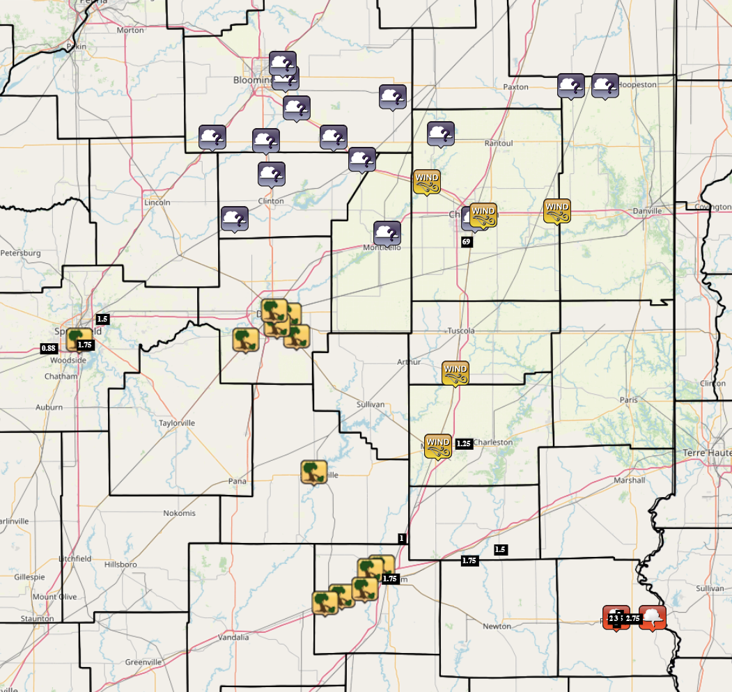
Fig. 1) Map of severe weather warnings across the state (gray icons are dust storm warning, yellow icons are damaging winds/wind gusts warnings, black icons are large hail warnings and red icons are funnel cloud warnings) from the NWS
Despite this event being rare for the region, dust storm season for the Northern Hemisphere is still in full swing, with optimal time being the spring to summer transition. Severe dust storm warnings are currently issued for most of Saudi Arabia as a Red Sea Trough and high pressure from the Mediterranean enhance northeasterly winds across the Peninsula. Dust storms are still possible through summer and into autumn, especially in North Africa and the Middle East, through climate trends show a peak in dust storms between April and May.
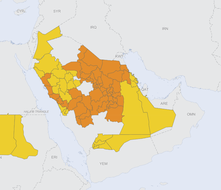
Fig. 2) Map of severe weather warnings for dust storms across the Arabian Peninsula (orange districts have severe dust storm warnings and yellow districts have moderate dust storm warnings) from the WMO
As for North America, another bout of severe thunderstorms is forecast for the Midwest, possibly reaching southwest and central Illinois before breaking down. We may not see another rare dust storm event from this one, but Monday’s and Tuesday’s convective outlooks indicate enhanced severe weather risks from Nebraska down to northern Texas... an area commonly known as Tornado Alley.
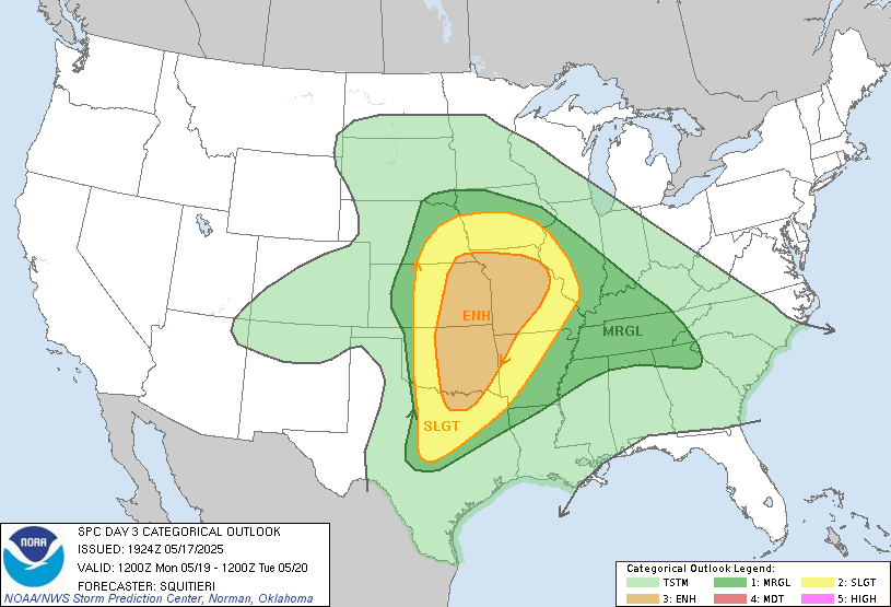
Fig. 3) Map of Day 3 convective outlook highlighting areas of enhanced severe weather risk (orange), slight severe weather rick (yellow) and marginal severe weather risk (green), from NOAA
- Other news
- Sat 17 May 2025 NSW fog lingers longer inland
- Fri 16 May 2025 First significant mainland snowfall this weekend
- Fri 16 May 2025 Cold and wet weekend ahead for Melbourne
- Thu 15 May 2025 Eastern NSW bracing for heavy rain
- Wed 14 May 2025 Australia's snow season forecast 2025: slow start then promising second half