News
‹ back to weather news
News
-
Wet and windy weekend for the west
Angus Konta, 14 September 2025Australia’s southwest corner is currently under the influence of a pair of winter-like cold fronts sweeping across the region, with a broad area of southwest and western WA under a severe weather warning and a coastal hazard warning.
The current severe weather warning is for damaging winds, which are expected to be a significant feature of the second cold front as it sweeps through the southwest. As of 10am, there have already been some damaging wind gusts recorded across coastal and near-coastal areas, including:
- 102km/h at Cape Leeuwin
- 98km/h at Busselton Jetty
- 96km/h at Cape Naturaliste
- 95km/h at Rottnest Island
- 82km/h at Mandurah
- 80km/h at Gooseberry Hill
Winds are expected to be peaking this morning along the west and southwest coast as the cold front crosses, then later in the day further inland and for the south coast as the front progresses towards the east, possibly gusting as high as 100km/h for some areas.
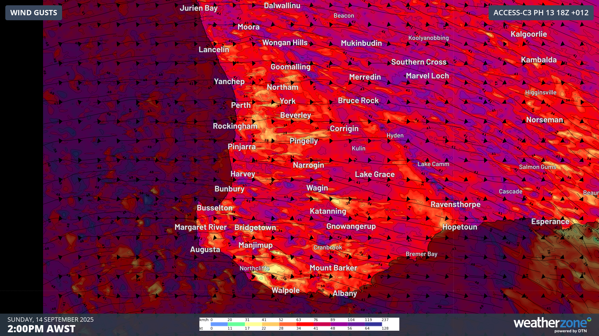
Image: Forecast wind gusts on Sunday afternoon for southwest WA according to ACCESS-C Perth model
The first cold front that crossed on Saturday served up some decent rainfall, with widespread totals of 15-30mm recorded for areas between Perth and Albany. The highest totals in the 24 hours to 9am include:
- 42mm at Jarrahdale
- 36mm at Glen Eagle and Mt Solus
- 32mm at Scott River
- 31mm at Bungendore
The second cold front is already bringing further scattered showers and some thunderstorms, putting a dampener on any outdoor plans. Overall, similar totals to Saturday’s rainfall are expected for today, with widespread weekend totals of 40-60mm a good chance.
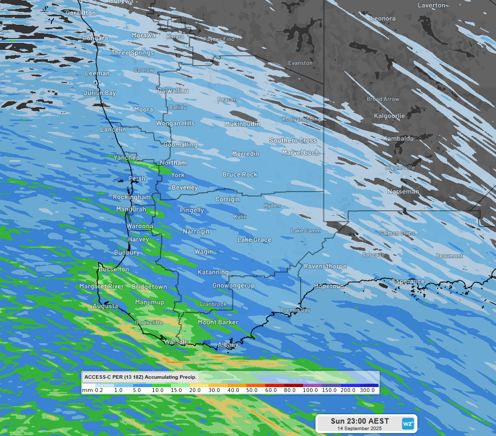
Image: Rainfall forecast for Sunday across southwest WA according to ACCESS-C Perth model
Despite the first cold front having already passed, Saturday night was quite balmy, with temperatures staying around 10-15°C across most of southwest WA overnight. Indeed, Perth’s lowest overnight temperature was 14.6°C, nearly 5 degrees above the September average. The balmy conditions will be short lived though, as the second front drags up particularly chilly air from the Southern Ocean. Much of southwest WA will reach their maximum temperature in the morning ahead of the cold front, before becoming progressively colder during the afternoon. Gusty southwesterly winds and showers will also make it feel bitterly cold across many locations, particularly for the south.
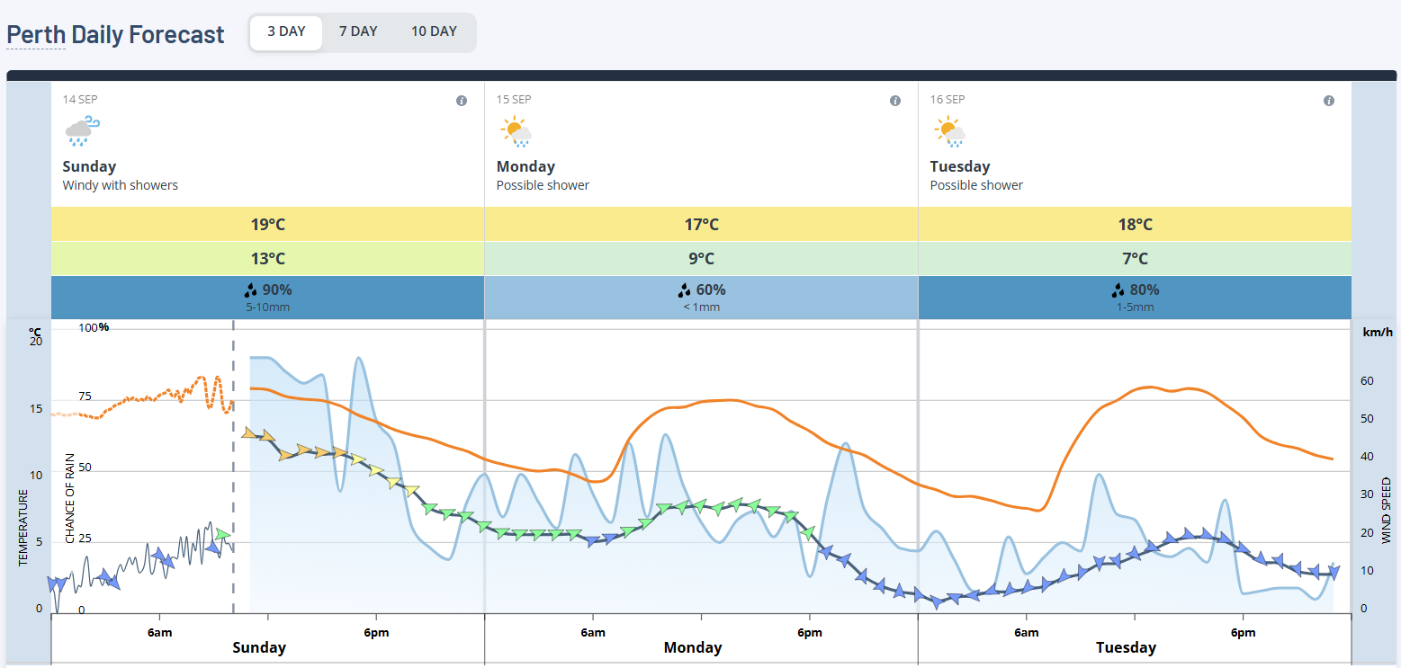
Image: 3 day forecast for Perth
Make sure to check the Weatherzone website for warnings and forecast information for Perth and other areas of southwest WA as the second cold front crosses the region.
- Other news
- Sat 13 Sep 2025 Spring warmth to spread across Australia's southeast
- Fri 12 Sep 2025 An avalanche and an unusual Aussie snowfall
- Thu 11 Sep 2025 La Niña more likely this year after BoM switches to new index
- Thu 11 Sep 2025 Sydney's wettest September day in 146 years
- Wed 10 Sep 2025 Tornado observed near Young, NSW