News
‹ back to weather news
News
-
Tropical cyclone risk increasing near northern Australia
Ben Domensino, 18 November 2025A tropical low located to the north of Darwin has a high chance of becoming a tropical cyclone this week, with landfall over the NT coast possible on the weekend.
At 3:30pm ACST on Tuesday, November 18, a tropical low was located about 270 km north of Darwin and moving towards the east northeast at roughly 9 km/h.
The system slowly gained strength on Tuesday as it drew energy from the warm Timor Sea, where sea surface temperatures are currently around 30 to 31°C. This is much warmer than the 26.5°C threshold required for tropical cyclone formation.
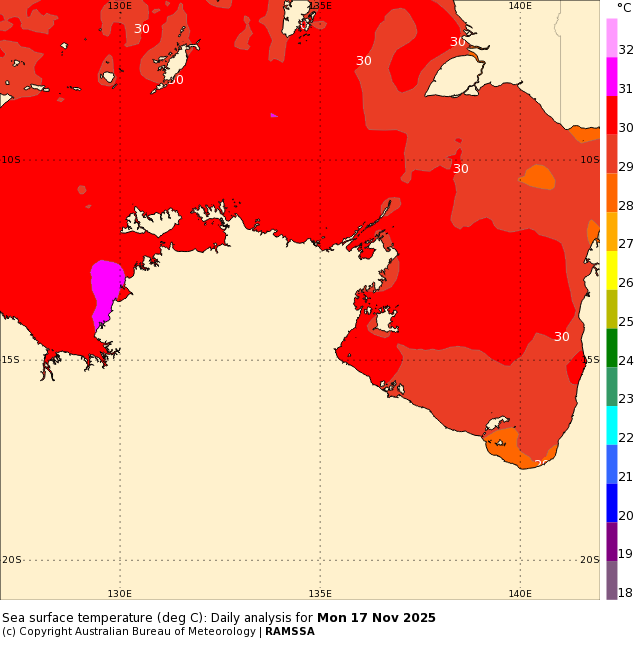
Image: Sea surface temperatures to the north of the NT earlier this week, showing water temperatures around 30 to 31°C. Source: Bureau of Meteorology.
The warm seas and favourable atmospheric conditions should help the low pressure system mature into a relatively small tropical cyclone by Thursday. The small size of ths system will help it gain strength more quickly than a larger tropical cyclone would.
While there is still lots of uncertainty about this system’s future track and strength, some computer models suggest it could approach the northern coast of the NT’s Top End this weekend. At this stage, there is a chance that we could see a category two tropical cyclone approaching the Tiwi Islands on Saturday before the system moves to the west of Darwin on Sunday.
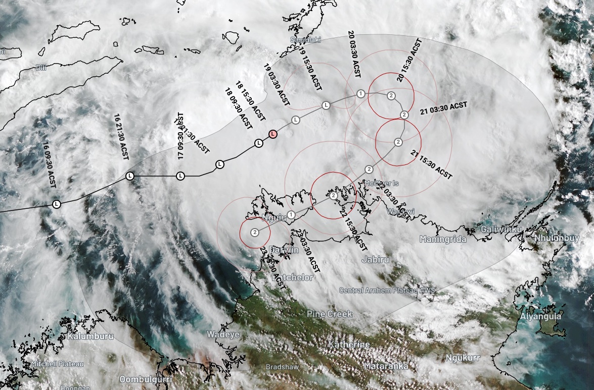
Image: Extended tropical cyclone forecast track map from the Bureau of Meteorology, showing potential for a tropical cyclone to impact the NT’s Top End later this week. Source: Weatherzone.
It’s too early to know exactly how this developing tropical low will impact the NT in the coming days. However, cyclonic impacts including heavy rain, damaging winds, large waves and a storm surge are possible in parts of the NT later this week.
Anyone living in the north of the NT and WA’s Kimberley region should stay up to date with the latest tropical cyclone advisories in the coming days. Forecasts and warnings may change from day-to-day as more accurate information becomes available to meteorologists.
In addition to the official advisories, you will also find regular updates about this system on the Weatherzone news feed.
- Other news
- Tue 18 Nov 2025 Perth Ashes Test weather: slight chance of showers on first two days then mostly clear
- Mon 17 Nov 2025 High tropical cyclone risk near Australia this week – rare November landfall possible
- Mon 17 Nov 2025 Extreme fire danger and snow on the same day in NSW
- Sun 16 Nov 2025 November heat, then storms on the way for western WA
- Sat 15 Nov 2025 Total Fire Bans issued as heat intensifies over NSW then Qld