News
‹ back to weather news
News
-
November heat, then storms on the way for western WA
Angus Konta, 16 November 2025A taste of summer is on the way for parts of the west coast, as hot northeasterly winds drag heat from the western interior down to the west coast early in the week. Heat will then be followed by a multi-day outbreak of thunderstorms for western and southwest WA.
The culprit of the incoming hot weather is a deepening trough over the Pilbara which will extend over the Gascoyne today. By tomorrow, the trough will extend offshore from the Midwest coast, allowing hot winds from the interior to draw heat to near coastal areas as far south as Perth.
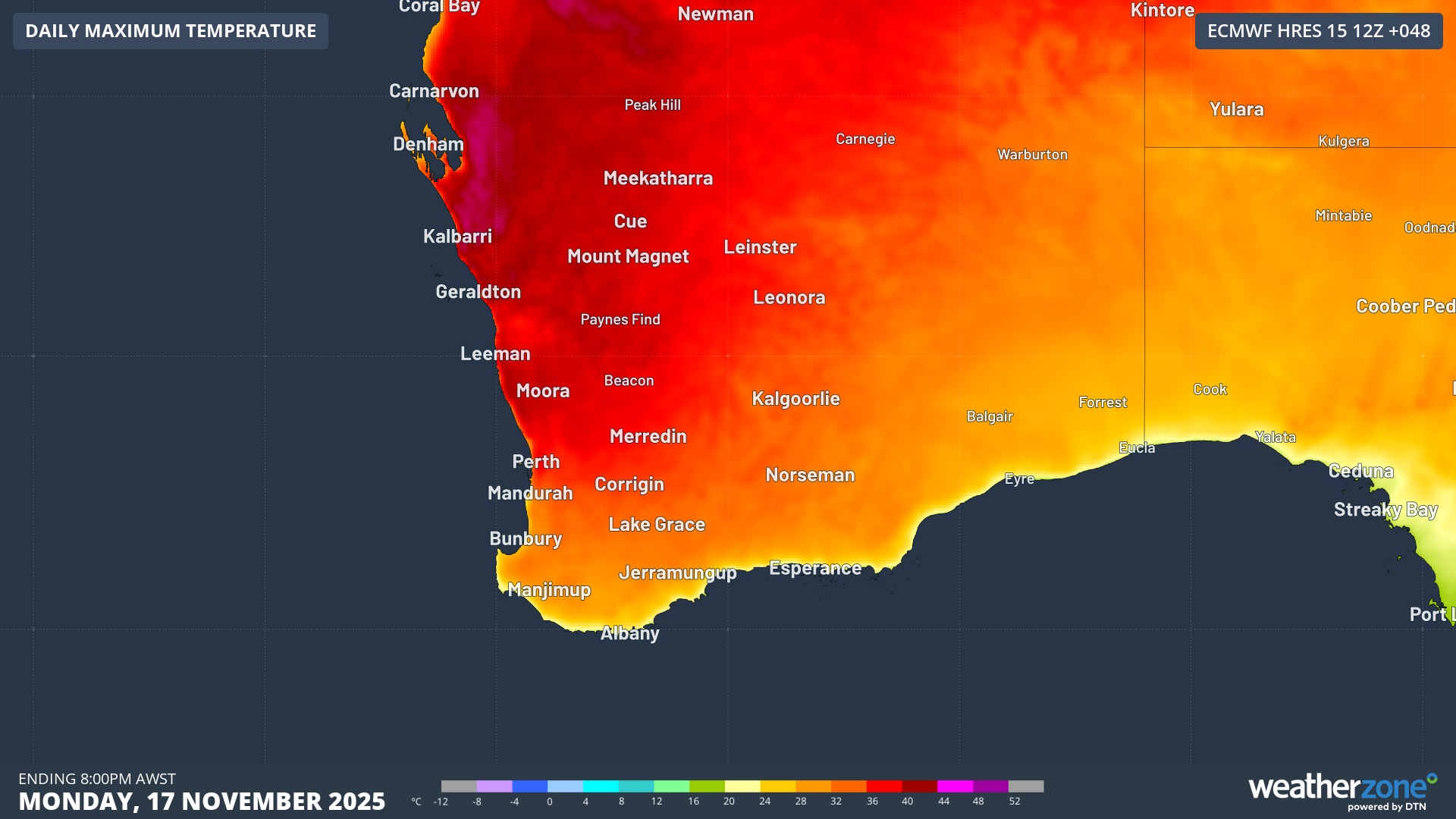
Image: forecast maximum temperatures on Mon 17th
As it stands, temperatures are expected to reach the mid to high 30s across large parts of western WA on Monday. Perth is looking at a forecast of 35°C, and Geraldton is forecast to reach 40°C, while temperatures exceeding 40°C are possible for inland Gascoyne and Central West.
While these temperatures are not unusual for summer, for some areas this will be the hottest day since last autumn. The increased heat is also expected to bring elevated fire danger, with Extreme Fire Danger ratings expected for several districts in the Central West forecast district on Monday.
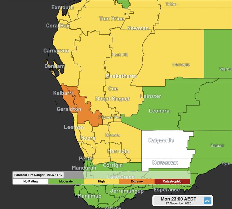 Image: WA Fire Danger Ratings on Monday 17th. Source: Bureau of Meteorology
 From Monday, the trough will also gain some moisture, creating the potential for thunderstorm activity across western and southwestern parts of the state during the week. Thunderstorms are most likely for Gascoyne and Central West forecast district on Monday, extending south and inland as the week progresses. These storms carry the potential to bring damaging wind gusts exceeding 90km/h.
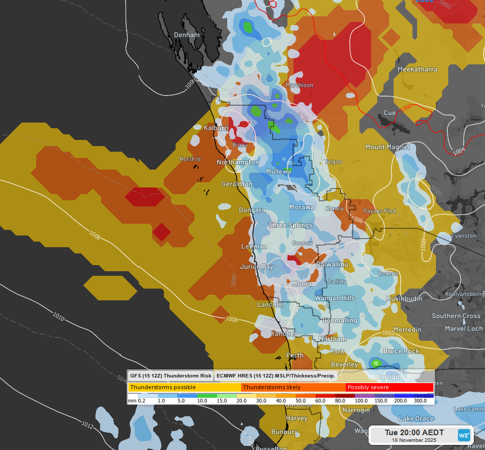 Image: 3 hourly precipitations to 5pm WST Tue 18th according to ECMWF Sat 12Z, overlaid with GFS thunderstorm risk
 Perth’s best chances for thunderstorms look to be on Wednesday and Thursday, with storms firing up towards the south coast by the end of the week.
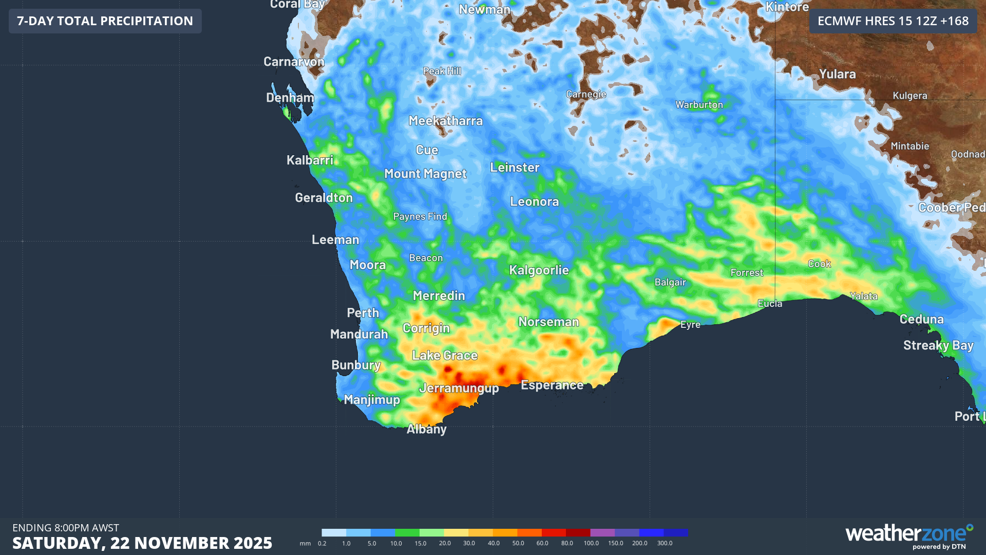
Image: Forecast accumulated rainfall to Saturday evening for southern and western WA according to ECMWF Sat 12Z
Showers and storms continue to be possible over western and southern WA over the weekend, although cricketing fans will be hoping that the wet weather stays away from Perth for the commencement of the Ashes Series this Friday.
- Other news
- Sat 15 Nov 2025 Total Fire Bans issued as heat intensifies over NSW then Qld
- Fri 14 Nov 2025 Widespread storms from Friday into the weekend – what's the risk in your area?
- Thu 13 Nov 2025 Warm blob of water increasing tropical cyclone potential near northern Australia
- Wed 12 Nov 2025 Australia on 'Aurora Alert' with severe geomagnetic storm in progress
- Wed 12 Nov 2025 Coldest November morning on record for parts of SE Australia