News
‹ back to weather news
News
-
Snow, bitter cold, on first day of Australian summer
Anthony Sharwood, 1 December 2025A light blanket of snow has fallen at the highest elevations of three states – Tasmania, Victoria and New South Wales – in a very wintry start to the Australian summer.
As a cold front sweeps across the southeast corner of the continent, our two southernmost capital cities – Melbourne and Hobart – are both heading for maximums of just 15°C this Monday, December 1. For Melbourne, 15°C is the average maximum temperature in August, the third month of winter.
This was the scene on Monday morning as the sun briefly popped out between snow showers at Thredbo in the Snowy Mountains of NSW, with settled snow down to about 1600 metres.
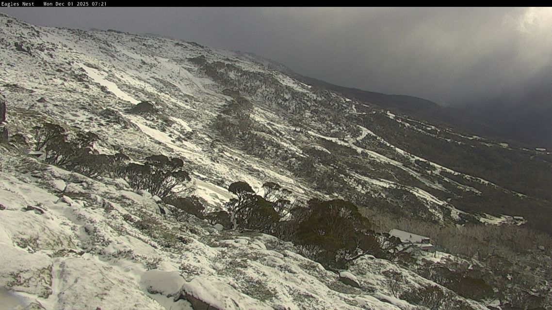
Image: The date stamp confirms that this is indeed Australian snow on December 1, 2025. Source: ski.com.au.
One Snowy Mountains local got out the skis and hiked up to the top of Mt Perisher, where between 10 and 15 cm had accumulated above about 1800m, with snow showers continuing.
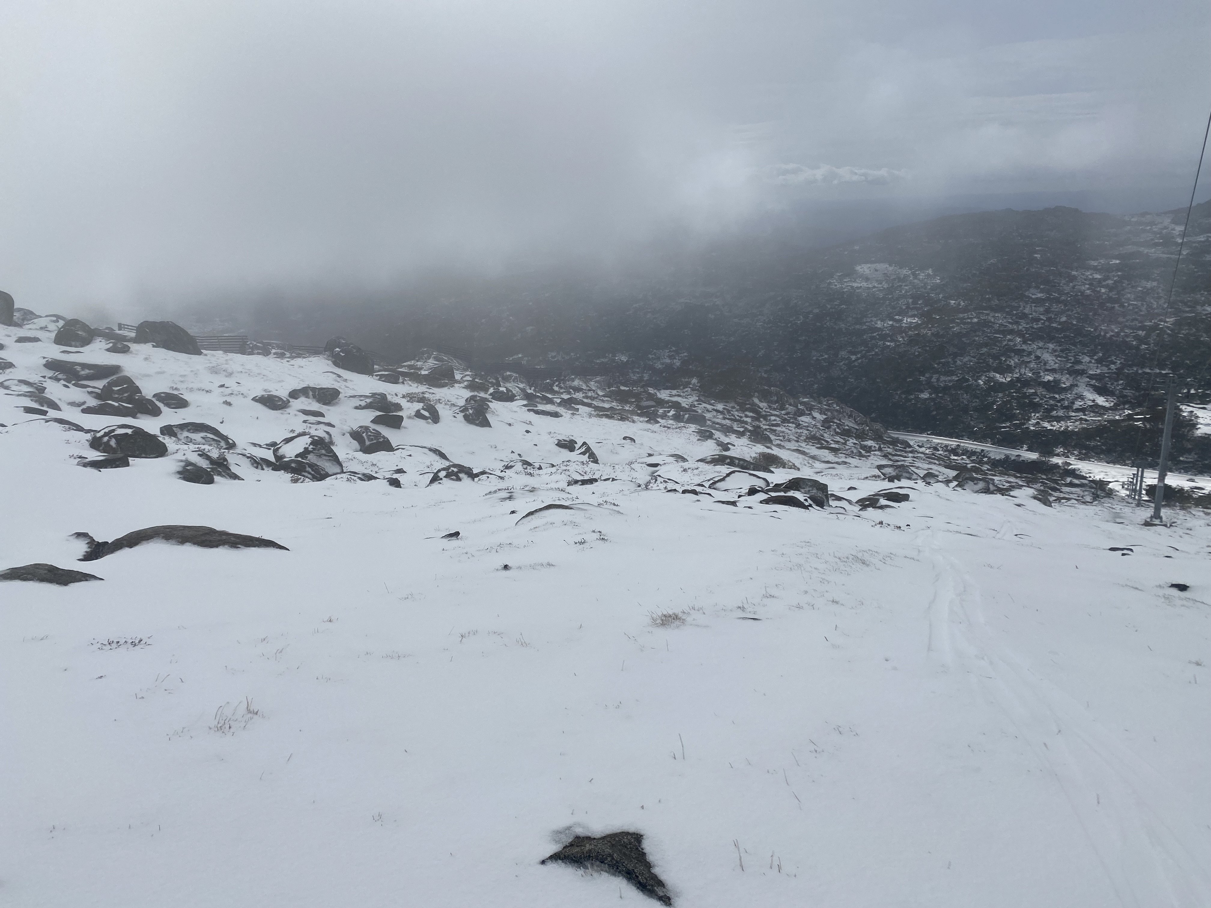
Image: Mt Perisher, NSW, on December 1, 2025. Source: Steve Smith.
You can see the feed of moist, chilly air with polar origins surging across Tasmania and the southeast mainland in the combined radar and satellite loop below.
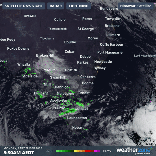
Image: Combined satellite and radar loop across Tasmania and SE Australia on the morning of Monday, December 1, 2025.
How rare are summer snowfalls in the Australian high country?
As we wrote last week as weather models started predicting Monday's unseasonably chilly start to summer, summer snowfalls on the highest parts of Australia are actually not that unusual.
Airmasses originating in polar latitudes tend to brush southern Australia at least once or twice during the three months of summer. These cold outbreaks are usually short-lived, and that will be the case this week. For example, Melbourne is heading for highs of 28°C by Wednesday and 33°C by Thursday.
The incidence of polar outbreaks tends to be much more likely during a negative phase of the Southern Annular Mode (SAM). As the graph below shows, the SAM is as low as it has been over the past 12 months.
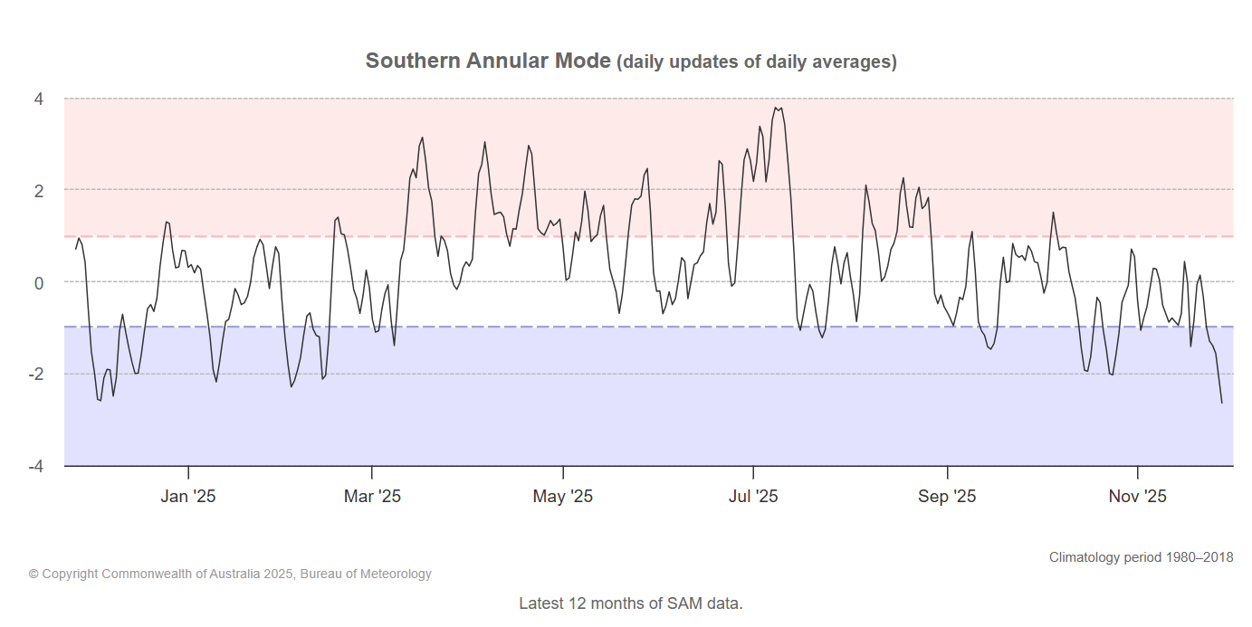
Image: Phases of the Southern Annular Mode over the past 12 months to November 28, 2025. Source: BoM.
Does today's weather mean Australia likely to have a cool summer?
Not necessarily, no.
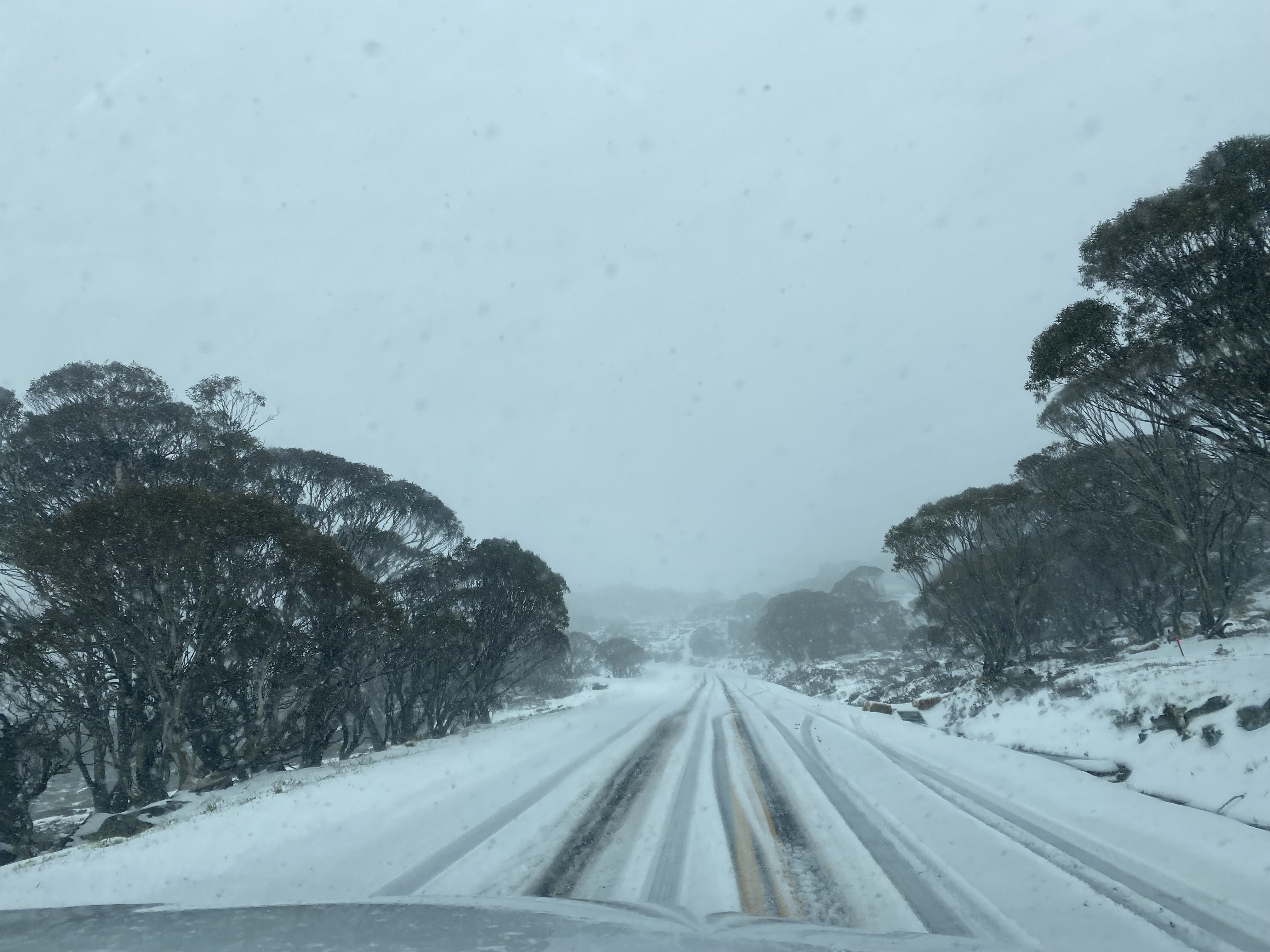
Image: The Kosciuszko Road near Charlotte Pass, NSW, on December 1, 2025. Source: Steve Smith.
As Weatherzone meteorologist Ben Domensino explained last week, it is tricky to predict what will happen this Australian summer due to the competing influence of two climate drivers – the negative SAM and the La Niña which has just been declared. There is also uncertainty regarding the future development of the SAM into December.
The BoM’s latest climate outlook predicts that daytime temperatures are likely to be above average across most of Australia from December through to February, with overnight temperatures very likely to be above average across most of Australia.
The BoM also predicts that despite the typically wet influence of La Niña, rainfall is likely to be below average for parts of the west and inland parts of the east, with roughly equal chances of above or below average rainfall across the south and along the east coast.
- Other news
- Sun 30 Nov 2025 Contrasting start to summer expected for Australia’s west and southeast
- Sat 29 Nov 2025 The most sweltering November night for Queensland
- Fri 28 Nov 2025 La Niña declared days out from summer – what does this mean for Australia?
- Thu 27 Nov 2025 Australian summer to start with snowfalls
- Wed 26 Nov 2025 Why is the weather so volatile in eastern Australia this week?