News
‹ back to weather news
News
-
Lightning, hail and deluges thrashing Qld and NSW
Quincy Tut, 1 November 2025It was forecast, and it eventuated. Violent thunderstorms that have brought everything from giant hail, deluges and wind gusts exceeding 100km/h are continuing throughout southeast Queensland and northeast NSW on Saturday afternoon.
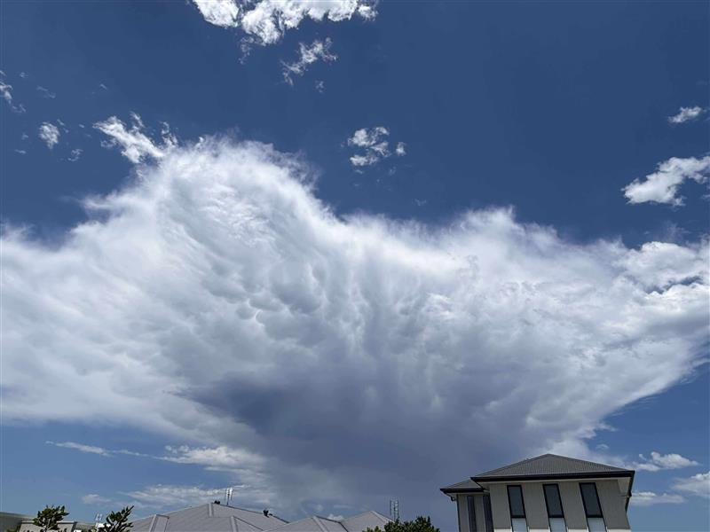
Image: A convective cell with developing mammatus. Sunshine Coast, Qld. Source: James Wall, Weatherzone Meteorologist.
Multiple severe thunderstorm warnings have been issued by the Bureau of Meteorology for Queensland on Saturday afternoon, dictating the movement several convective cells surrounding the Brisbane area as well as extending through the Darling Downs & Granite Belt district and into the Central Highlands & Coalfields. Some notable observations include:
- 9cm diameter hailstones at 1:03pm at Pratten
- A 104km/h wind gust at Dalby at 4:14pm accompanying 10-minute rainfall totals of 11mm to 4:20pm. The wind gust is the highest that Dalby has seen in almost 5 years.
- A 13-degree temperature drop in the 15 minutes from 3:50pm to 4:05pm just ahead of the storm cell.
- Earlier in the afternoon, Brisbane received 6mm in the 10 minutes to 3:30pm with a passing storm cell.
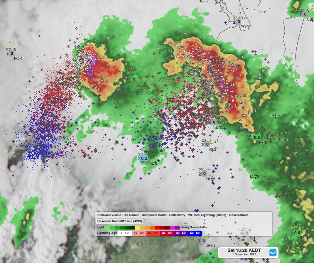
Image: Extent of thunderstorms (crosses) with 10-minute observed rainfall (numbers) overlaid on Himawari Satellite Imagery at 3:20pm AEST on Saturday, 1st November over the Brisbane area.
In New South Wales, a similar warning has been issued, stretching from the Northern Rivers, through the Northern Tablelands and into the northern Hunter area, among others. Some notable observations include:
- 7cm diameter hail at North Dorrigo at 3:20pm
- 90mm of rainfall in the hour to 5:00pm at Glenreagh.
- A 74km/h wind gust at Grafton at 5:45pm accompanying 29mm in the 10 minutes to 5:50pm. The wind gust is the highest Grafton has seen since September 2024.
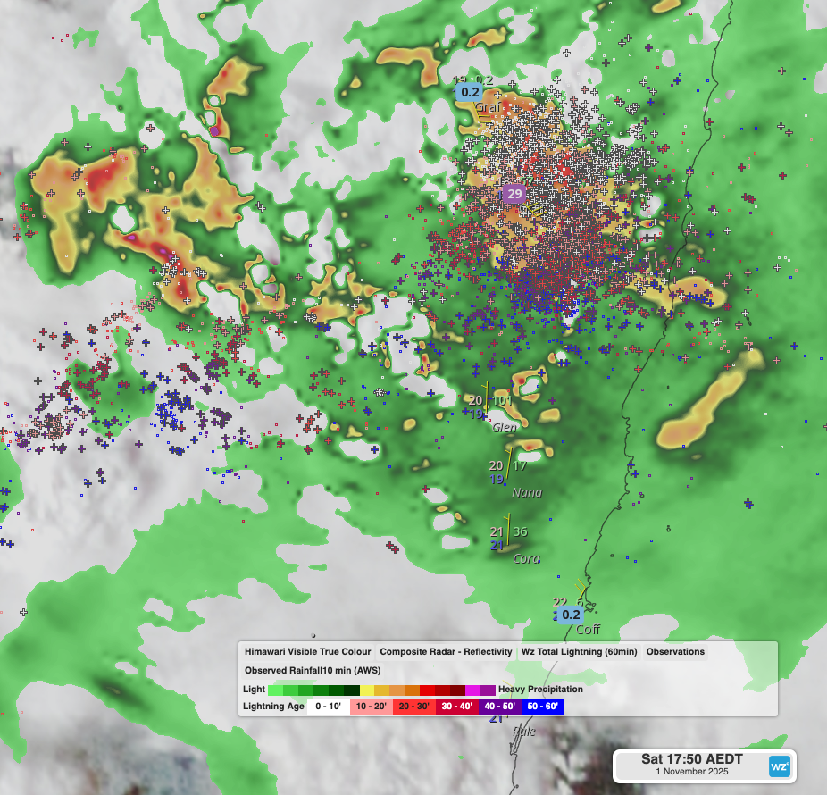
Image: Extent of thunderstorms (crosses) with 10-minute observed rainfall (numbers) overlaid on Himawari Satellite Imagery at 5:50pm AEDT on Saturday, 1st November over the Grafton area.
Severe weather in the east is expected to continue during Sunday with the persistence of a surface trough. Be sure to check the latest warnings for upcoming severe weather on our website.
- Other news
- Fri 31 Oct 2025 Warmest October on record for Sydney, Brisbane
- Fri 31 Oct 2025 Late spring ice cliffs on Australian alpine creeks
- Thu 30 Oct 2025 Days of severe thunderstorms ahead for Qld, NSW
- Thu 30 Oct 2025 Melbourne Cup 2025 weather: Rain and wintry temperatures in Melbourne on Monday, Tuesday
- Wed 29 Oct 2025 Why was Hurricane Melissa so strong when it hit Jamaica?