News
‹ back to weather news
News
-
Negative Indian Ocean Dipole a near-certainty to develop
Joel Pippard, 3 September 2025A negative Indian Ocean Dipole event is a near certainty to develop in 2025 as both the oceans and atmosphere show strong signs of coupling.
What is the Indian Ocean Dipole?
The Indian Ocean Dipole (IOD) is a climate driver that involves the movement and location of warmer and colder waters along the equator in the Indian Ocean. These ocean movements have a corresponding effect on the atmosphere above those waters, that change the regional rainfall patterns.
A negative IOD is associated with warmer waters near Indonesia, and cooler waters near the Horn of Africa. The atmosphere responds by increasing convection near Indonesia, that then flow through to Australia and typically increase rainfall over much of the west and southeast of the country via northwest cloudbands. So far this century, there have been four negative IODs: 2010, 2016, 2021 and 2022.
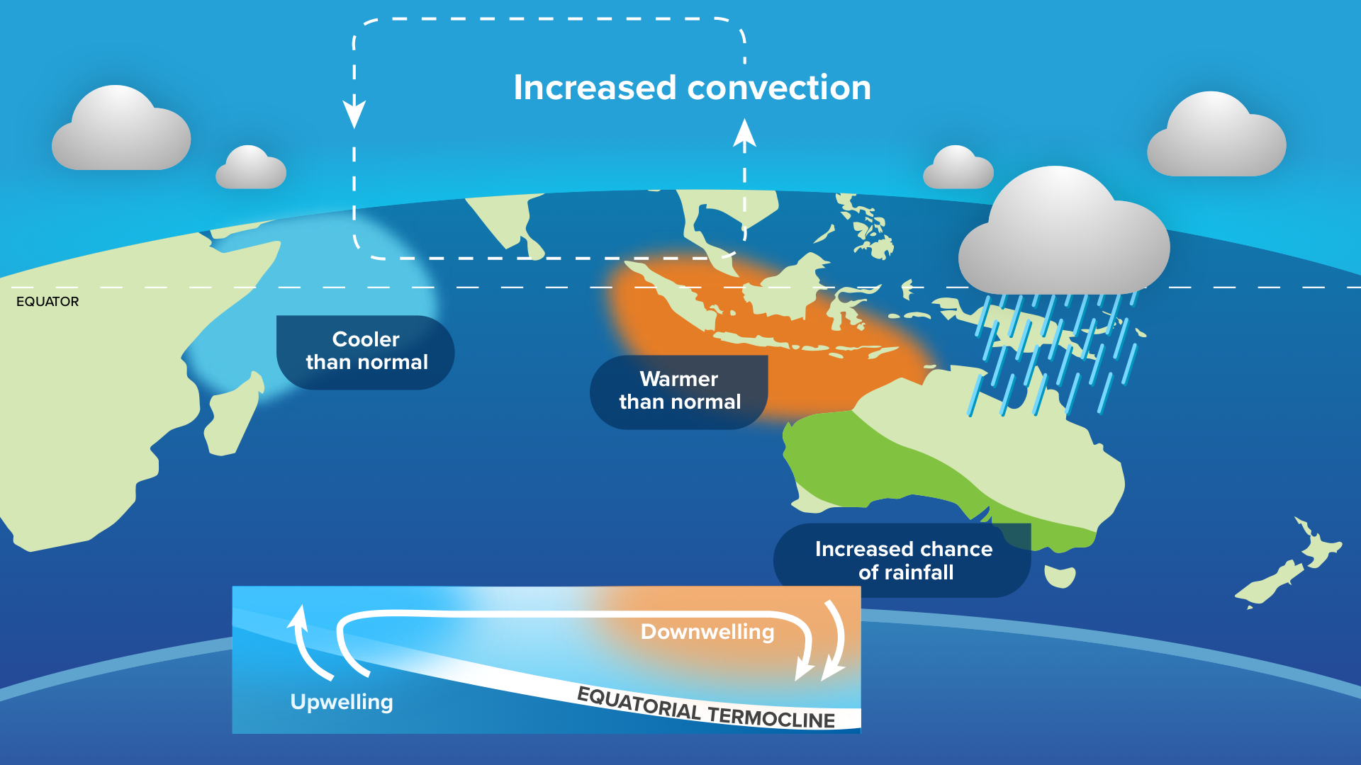
Image: The typical setup and impacts of a negative IOD.
The intensity of the IOD is measured with the IOD Index, which is the difference between sea surface temperature anomalies in the IOD West (near Africa) and IOD East (near Indonesia). For an IOD event to become offical, the index needs to be above +0.4°C for a positive event or below –0.4°C for a negative event for at least eight consecutive weeks.
What is the IOD doing in 2025?
Since late July, the IOD index has been steadily falling. In the week to August 31st, the index fell to –1.28°C, its lowest value for 3 years, and the tenth lowest weekly value on record (records since 2008). Only weeks in 2022, 2016 and 2010 were lower, meaning this event is already more intense than in 2021 negative IOD event.
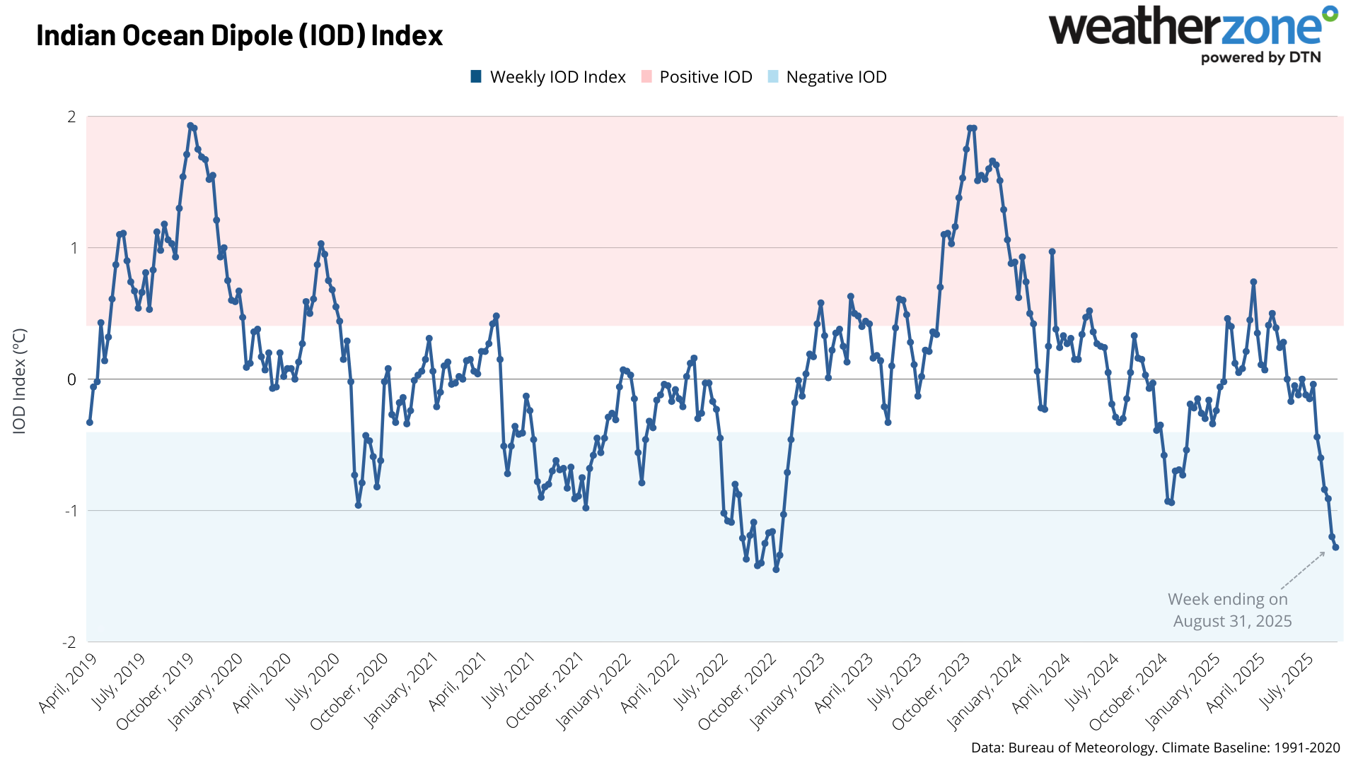
Image: Weekly IOD index since April 2019. Sustained values in the blue region are associated with a negative IOD. Source: BoM
The latest reading is the sixth consecutive reading below the threshold of –0.4°C and is a near-certainty to continue to meet the definition of a negative IOD event by mid-September.
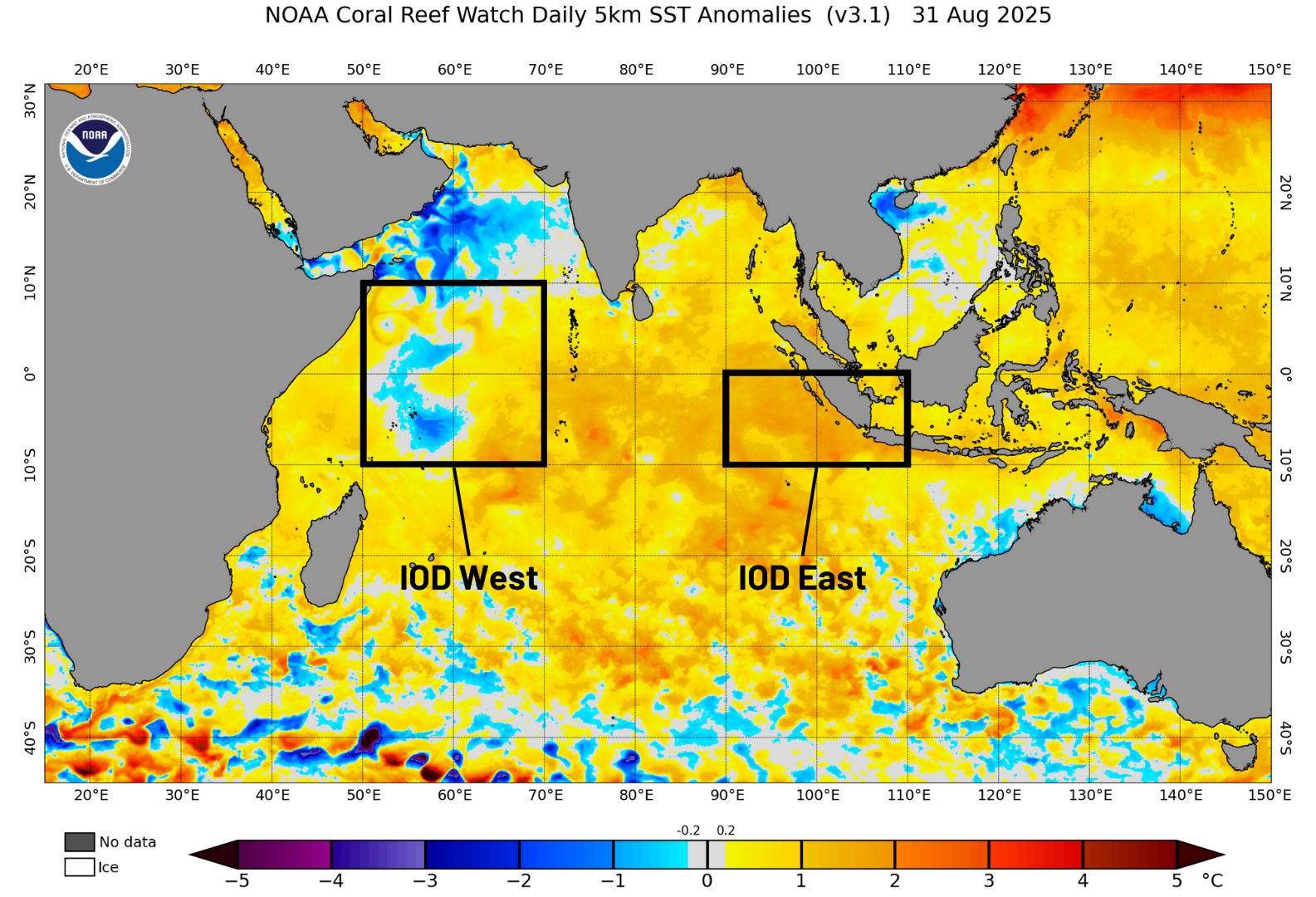
Image: Sea surface temperatures over the Indian Ocean show cooler than normal waters near Africa and warmer waters near Indonesia; a sign of a negative IOD. Source: NOAA
There is strong evidence to show that the atmosphere has responded to match the ocean temperatures as well. During a negative IOD event, winds tend to converge to waters just off Indonesia, and the increased convection leads to more rainfall in the area. Conversely, near Africa winds diverge away from the area, and less rainfall falls.
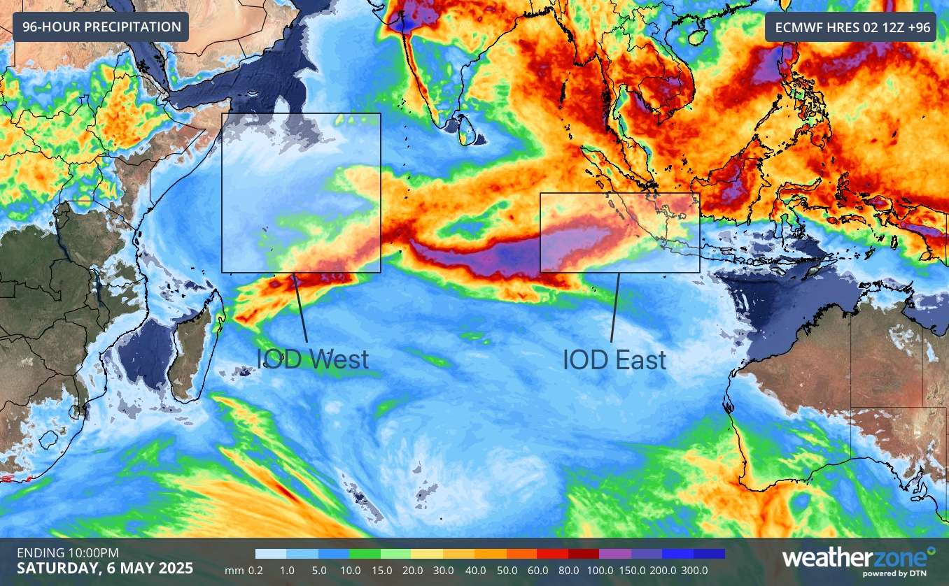
Image: ECMWF forecast 4-day rainfall to Saturday evening over the Indian Ocean
From the forecast rainfall above, heavy rain (purple shading) is expected over the equatorial east of the Indian Ocean, with substantially less (light blue shading) occurring near Africa. This is a symptom of the established negative IOD pattern.
These atmospheric responses to the oceans help to congregate more warm water near Indonesia and upwell cold water near Africa, via a process known as Ekman transport. This amplifies the initial change and creates a positive feedback loop that help to self-sustain the negative IOD event. Now that this process is well established this year, it will continue until it is significantly interrupted, likely by the arrival of the Northern Australian Monsoon in early summer.
With this year's likely negative IOD being the major climate driver to impact Australia, climate outlooks are suggesting wetter than average conditions for much of northern and eastern Australia during spring. You can see the latest climate rainfall and temperature forecast maps here.
- Other news
- Wed 03 Sep 2025 First burst of spring warmth for southern capitals
- Tue 02 Sep 2025 Sydney's wettest winter in 18 years
- Mon 01 Sep 2025 Australian snow season cracks the 2-metre mark
- Sun 31 Aug 2025 Cold, crisp start for Sydney Marathon 2025
- Sat 30 Aug 2025 Gusty polar blast turns southeast Australia snow white