News
‹ back to weather news
News
-
Gusty polar blast turns southeast Australia snow white
Corine Brown, 30 August 2025Ski resorts in Tasmania and on the mainland are celebrating a bumper snowstorm this weekend, as a frigid airmass originating in Antarctica was pushed north over southern Australia overnight, dumping fresh powder over alpine ranges.
In Tasmania, Ben Lomond Alpine Resort reported at least 15 cm of fresh snow overnight, while Mount Mawson reported around 5-10 cm in the past 24 hours.
On the mainland, though, there was even more cause to celebrate.
Resorts across the Vic and NSW alpine ranges, all received 20-26 cm of fresh snow in the 24 hours to 9am today. This bumper crop helped Perisher crack the 2-metre mark in total snow depth, with a 2.1 m depth now recorded over the course of the 2025 snow season. There were even reports of people being snowed in at Perisher this morning. Meanwhile, Falls Creek experienced its lowest maximum temperature in four years today in that frigid air, with the mercury rising to only -3°C.
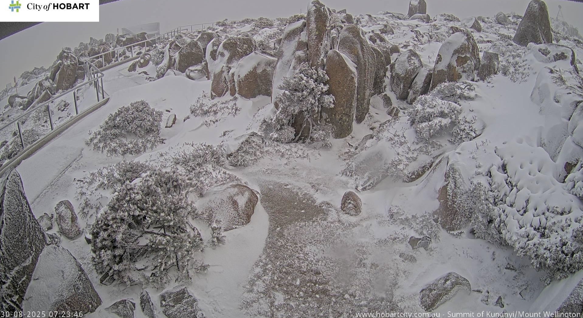
But if you thought it was only the alpine regions that received a healthy dose of powder with this system, think again. In Tasmania, kunanyi/Mount Wellington, just outside of Hobart, was turned white, making for a beautiful winter scene on the summit’s webcam.
 Image: The summit of kunanyi/Mount Wellington was turned white this morning, Saturday, August 30. Source: City of Hobart
 But that’s not all. Snow fell down to about 900 m on the mainland, with reports of snow gracing the Mount Lofty Ranges in SA overnight, as well as snowfall on Mount Macedon, about an hour north of Melbourne, and Mount William in Victoria’s Grampians National Park.
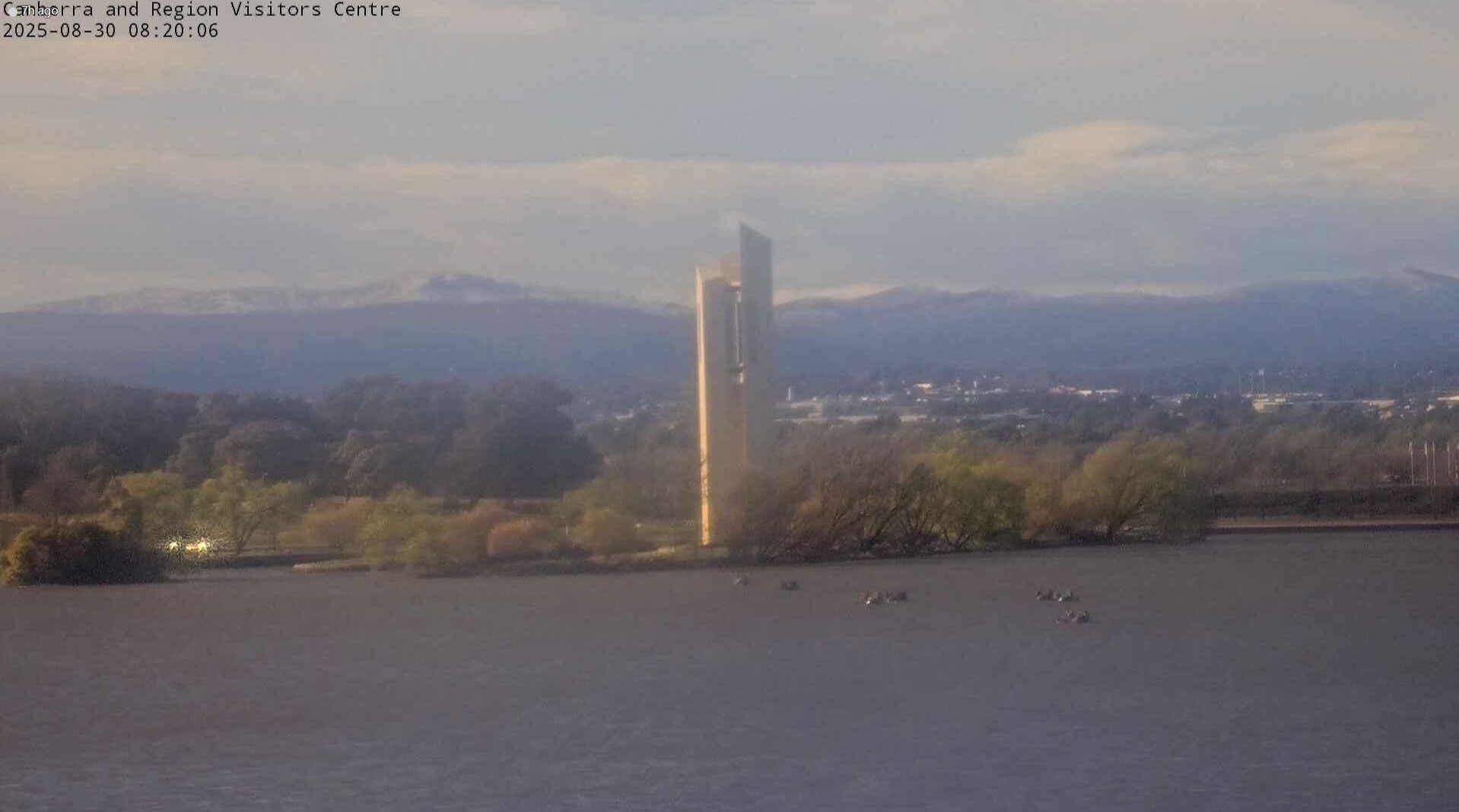
In the ACT, snow was visible on the Brindabella Ranges outside of Canberra, with reports of decent snowfall at Corin Forest, which has an elevation of about 1200 m.
 Image: Snow caps the Brindabella Ranges outside of Canberra this morning, Saturday, August 30. Source: Canberra and Region Visitors Centre.
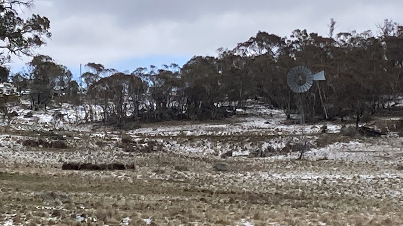
 A little further south, just outside of Cooma, NSW, our very own Anthony Sharwood captured this rather picturesque scene:
 Image: Snow settling on the ground near Cooma, NSW, on Saturday, August 30. Credit: Anthony Sharwood.
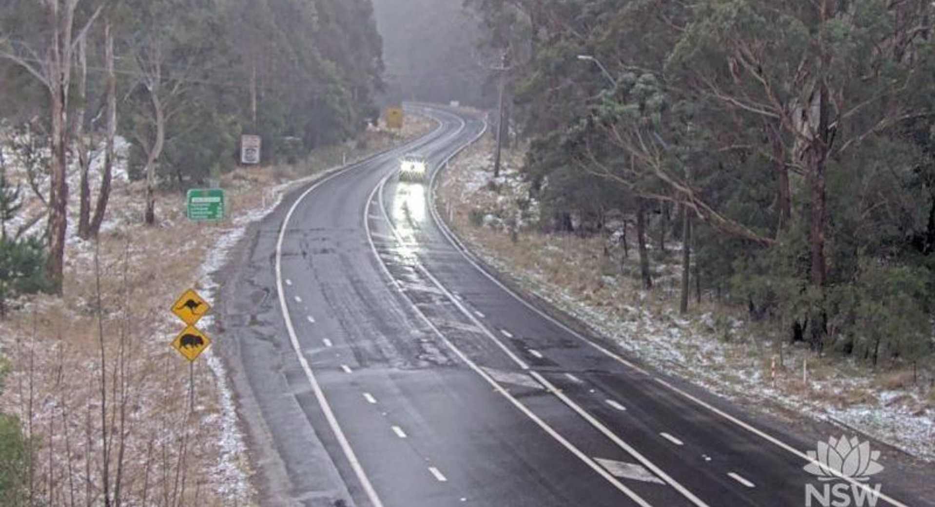
 And in central NSW, snow fell to at least 1100 m, with a traffic camera at Hampton, about 30 minutes south of Lithgow in the Blue Mountains, capturing snow settling on the ground this morning. There were also reports of snow in Orange and Oberon in the Central Tablelands.
 Image: Snow settling at Hampton NSW this morning, Saturday, August 30. Source: Live Traffic NSW.
 Snow wasn’t the only thing that this Antarctic airmass brought. Over the past two days, the system has generated wind gusts of around 100 km/h or more at various locations in each southeastern state, including:
Victoria
- 124 km/h at Mount Buller (sustained winds of 91 km/h)
- 118 km/h at Mount Hotham (sustained winds of 80 km/h)
- 117 km/h at Wilsons Promontory (sustained winds of 96 km/h)
- 115 km/h at Cape Nelson (sustained winds of 96 km/h)
- 107 km/h at Mount William (sustained winds of 78 km/h)
- 107km/h at Gabo Island (sustained winds of 96 km/h)
- 106 km/h at St Kilda Harbour (sustained winds of 80 km/h)
- 104 km/h at Falls Creek (sustained winds of 78 km/h)
- 104 km/h at Port Fairy (sustained winds of 74 km/h)
- 104 km/h at Aireys Inlet (sustained winds of 72 km/h)
- 102 km/h at Warrnambool Airport (sustained winds of 82 km/h)
New South Wales
- 115 km/h at Green Cape (sustained winds of 89 km/h)
- 113 km/h at Cabramurra (sustained winds of 78 km/h)
- 102 km/h at Bellambi (sustained winds of 69 km/h)
South Australia
- 120 km/h at Neptune Island (sustained winds of 107 km/h!)
- 102 km/h at Mount Gambier
Tasmania
- 102 km/h at Cape Grim, Tasman Island, and Hartz Mountain
- 100 km/h at Larapuna (Eddystone Point)
Conditions are easing for southeastern Australia this afternoon, with a few snow flurries possible over central Tas and the mainland ski fields for the remainder of the day. Gusty winds will likely continue over Tas into the night, but these are not expected to reach damaging levels except in the far south and possibly over the central highlands.
But the take-home message is this: if you’re into snow sports, tomorrow is going to be a cracker of a day to hit the slopes after all that fresh snowfall, so cap off your weekend with a visit to the ski fields if you can.
- Other news
- Fri 29 Aug 2025 Antarctic air to bring low-level snow in southeastern Australia
- Fri 29 Aug 2025 Rare tornado warning in Adelaide as storms, powerful winds slam SA
- Thu 28 Aug 2025 Northern WA and Southeast Australia face elevated fire risk this spring
- Thu 28 Aug 2025 Days of damaging winds ahead for southeastern Australia
- Wed 27 Aug 2025 Massive real-time temperature contrasts across Australia

