News
‹ back to weather news
News
-
Prolonged cold wet spell for southwest WA
Anthony Sharwood, 18 July 2025Perth and the whole of Western Australia’s South West Land Division is facing a spell of heavy showers and chilly temperatures lasting several days from Sunday onwards, with potentially the coldest day of the year at many locations on Monday.
Up to 50mm of rain could fall between Sunday and Thursday, with possible localised rainfall totals approaching 100mm at some coastal spots.
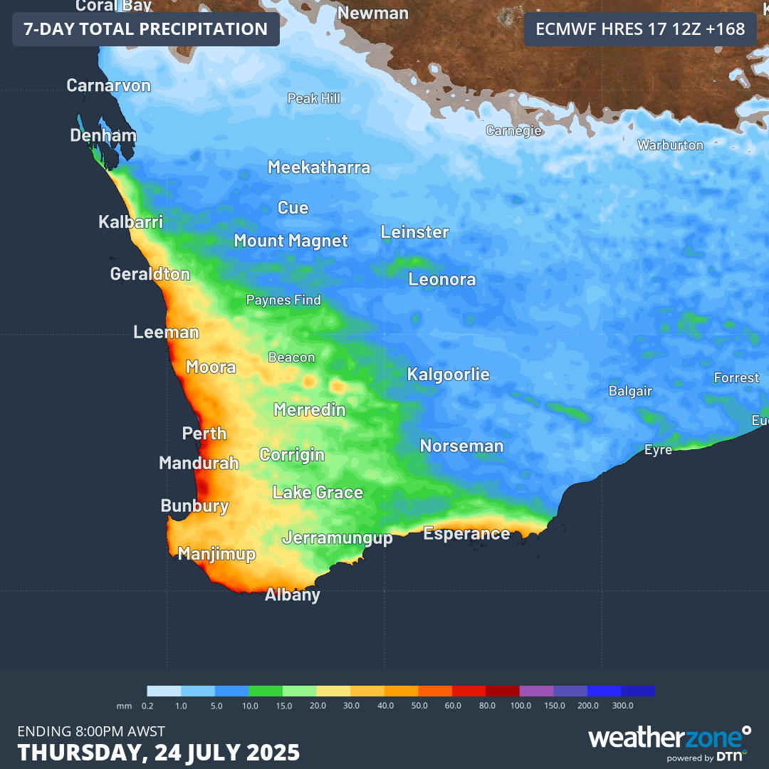
Image: Predicted rainfall accumulation in southwest WA from Friday, July 18 to Thursday, July 24 according to the ECMWF model.
While this rain will make outdoors activities uncomfortable next week, it will be welcomed by many locals, especially in Perth and further north into the wheat belt.
While some spots in the far southwestern tip of WA have enjoyed extremely heavy rainfall so far this winter, totals have tended to drop off markedly from about Perth northwards.
- For example Busselton, just over 200km south of Perth, had a very healthy 163.8mm in June (monthly average 122.2mm) and has already had 192.8mm in July (monthly average 136.1mm).
- But Perth itself is yet to reach its average monthly rainfall total in any month thus far in 2025, even though June came close with 119mm (monthly average 127.1mm).
- In the wheatbelt town of Northam, about 100km NE of Perth, the 2025 winter rainfall has been well down on average to date, with a running total of just 56.6mm (the seasonal average is 218.9mm).
So the story of winter 2025 to date in the South West Land Division is that solid rain is still very much needed in many areas, especially north of Perth. But the ongoing story is that rain is always welcome at any location, given the historically dry conditions in recent years.
The map below shows rainfall deficiencies in Australia in the 27 months from the start of April 2023 to the end of June this year. As you can see, southwest WA has been one of the driest parts of the country along with parts of southern SA, western Vic and western Tas.
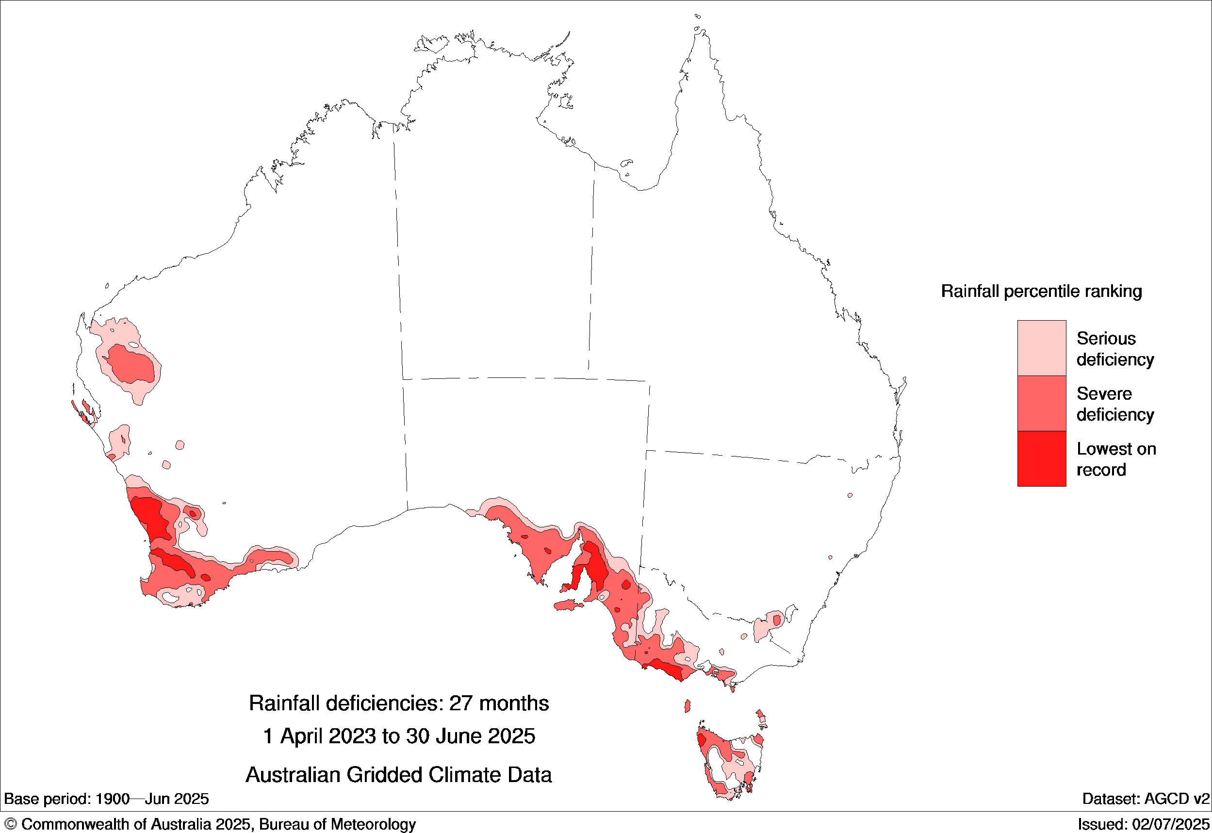
Image: Rainfall deficiencies in the 27 months to the end of June, 2025. Source: BoM.
That’s why a classic winter cold front of the type we’ll see approaching later this weekend is always welcome. Our predicted synoptic chart for Monday shows the front surging northwards, ushering in an unstable polar airmass.
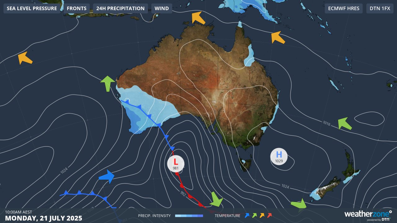
Image: Predicted surface level pattern for Australia at 10am on Monday, July 21, 2025.
Perth is heading for a maximum of just 15°C on Monday, while the mercury at many places inland or further south will peak closer to just 10°C.
A little snow is even possible on the Stirling Range near Albany early on Monday morning. The Stirling Range’s highest point is Bluff Knoll (1099m) and light snow tends to be recorded there at least once each year.
- Other news
- Fri 18 Jul 2025 Deepest July Australian snowpack in four years
- Thu 17 Jul 2025 Another relatively dry cold front teases Victoria
- Thu 17 Jul 2025 Powerful swells sweeping across Australia, Indonesia and the Pacific
- Wed 16 Jul 2025 Rare twin sets of 'morning glory' clouds over Gulf of Carpentaria
- Tue 15 Jul 2025 Snowy week in Tasmania with three cold fronts on the horizon