Forecast
-
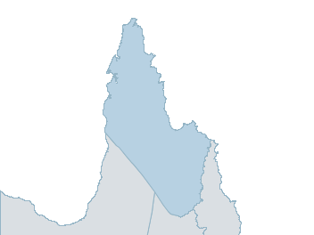
Map
peninsula Weather Forecast
For TuesdayDistrict Forecast

Sunday Partly cloudy. Slight chance of a shower N of Coen in the morning and afternoon. Near zero chance of rain elsewhere. The chance of smoke haze S of Coen. Light winds becoming E/NE 15 to 25 km/h in the morning then becoming light in the late evening. Overnight temperatures falling to the low to mid 20s with daytime temperatures reaching 35 to 40. 
Monday Mostly sunny. Slight chance of a shower N of Weipa, near zero chance elsewhere. The chance of a thunderstorm at night. Light winds becoming E/NE 15 to 20 km/h in the morning then becoming light in the late evening. Overnight temperatures falling to the low to mid 20s with daytime temperatures reaching 35 to 40. Tuesday Mostly sunny. Medium chance of showers S of Palmerville, slight chance elsewhere. The chance of a thunderstorm S of Coen. Light winds becoming E/NE 15 to 20 km/h during the day then becoming light during the evening. Overnight temperatures falling to the low to mid 20s with daytime temperatures reaching 35 to 40. Wednesday Mostly sunny morning. Medium chance of showers, most likely in the afternoon and evening. The chance of a thunderstorm in the afternoon and evening. Light winds becoming NE/SE 15 to 20 km/h during the day then becoming light during the evening. Overnight temperatures falling to the low to mid 20s with daytime temperatures reaching the mid to high 30s. -
National Forecast
-
weather_m_banner_320x50
-
Sydney: Mobile Map (33.8671°S, 151.2071°E, 74m AMSL) set your location ›
peninsula Weather Forecast
For TuesdayDistrict Forecast
Sunday Partly cloudy. Slight chance of a shower N of Coen in the morning and afternoon. Near zero chance of rain elsewhere. The chance of smoke haze S of Coen. Light winds becoming E/NE 15 to 25 km/h in the morning then becoming light in the late evening. Overnight temperatures falling to the low to mid 20s with daytime temperatures reaching 35 to 40. Monday Mostly sunny. Slight chance of a shower N of Weipa, near zero chance elsewhere. The chance of a thunderstorm at night. Light winds becoming E/NE 15 to 20 km/h in the morning then becoming light in the late evening. Overnight temperatures falling to the low to mid 20s with daytime temperatures reaching 35 to 40. Tuesday Mostly sunny. Medium chance of showers S of Palmerville, slight chance elsewhere. The chance of a thunderstorm S of Coen. Light winds becoming E/NE 15 to 20 km/h during the day then becoming light during the evening. Overnight temperatures falling to the low to mid 20s with daytime temperatures reaching 35 to 40. Wednesday Mostly sunny morning. Medium chance of showers, most likely in the afternoon and evening. The chance of a thunderstorm in the afternoon and evening. Light winds becoming NE/SE 15 to 20 km/h during the day then becoming light during the evening. Overnight temperatures falling to the low to mid 20s with daytime temperatures reaching the mid to high 30s.