News
‹ back to weather news
News
-
Tropical cyclone north of Australia, polar airmass to the south
Anthony Sharwood, 19 November 2025Australia is currently sandwiched between a tropical cyclone to the north and a strong polar airmass to the south, with dramatically different conditions in real time at opposite ends of the continent.
While it’s obviously commonplace for Australia’s temperate and tropical regions to have vastly different weather systems concurrently, Wednesday’s satellite image illustrates the contrast in unusually dramatic fashion.
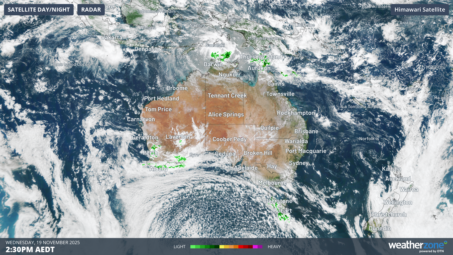
Image: Unsurprisingly due to the two systems mentioned in this story, western Tasmania and waters north of Darwin were seeing some of the heaviest showers anywhere in Australia at 2:30pm (AEDT) on Wednesday.
Up north: Tropical Cyclone Fina
Over the warm waters of the Timor Sea, Tropical Cyclone Fina continues to gain strength.
As Weatherzone meteorologist Ben Domensino explained earlier on Wednesday, Tropical Cyclone Fina is a small system, with gale force winds only extending about 50 to 60 nautical miles (approx, 90-110 km) from its core.
"Small tropical cyclones are able to fluctuate in strength more rapidly than larger systems, which means they can strengthen or weaken fairly quickly,” Domensino wrote.
Fina is expected to become a Category 2 cyclone on Wednesday night and remain at that strength until it makes landfall on Friday and into the weekend over the Tiwi Islands – just north of Darwin – and then possibly the mainland.
Down south: yet another strong spring cold front
Tasmania and the high country of NSW and Victoria have seen light or even moderate snowfalls up to four times already this November, and Tasmania is set for another round beginning this Wednesday evening.
The snow level could be as low as 600 metres in the state’s southwest by Thursday, with a snowline of 700 metres on the Central Plateau and on kunanyi/Mt Wellington above Hobart.
You can see the speckled cloud typical of airmasses with polar origins surging towards Tasmania and Victoria in the loop below.
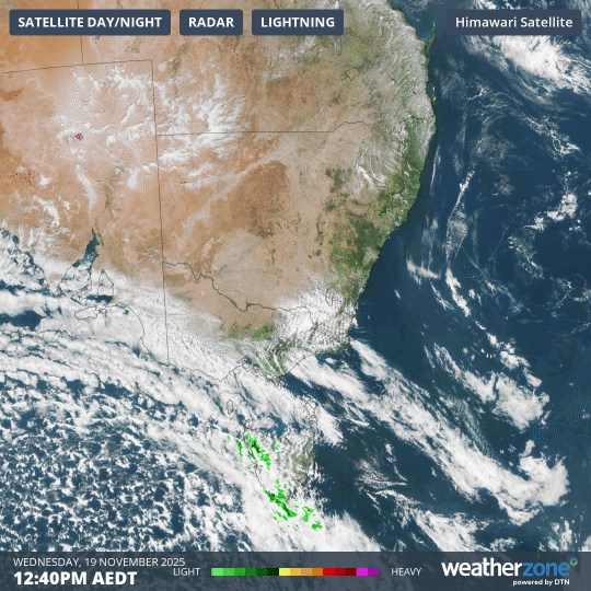
Image: Three-hour combined radar and satellite loop on Wednesday afternoon for SE Australia.
The speckled pattern occurs when very cold air moves over a relatively warm area of ocean, causing a large number of individual cumulus clouds to develop over a broad area.
Each of those cloud cells can produce rain, hail, snow and thunderstorms, with patches of clear sky in between, and the pattern they produce is in many ways as instantly recognisable as the swirling circular cloud mass of a tropical cyclone.
Australia is currently in a negative phase of the Southern Annular Mode (SAM). When the SAM is negative, the dynamic cold weather systems that circulate the globe in the Southern Ocean tend to be pushed northwards towards Australia.
READ MORE: Southern Annular Mode - What is the SAM and how does it affect Australia?
That’s what we’ve seen frequently this November, with average maximum temperatures in both Melbourne and Hobart trending well below the monthly average at this stage.
- Other news
- Wed 19 Nov 2025 Tropical Cyclone Fina forms north of Darwin, landfall possible this weekend
- Tue 18 Nov 2025 Tropical cyclone risk increasing near northern Australia
- Tue 18 Nov 2025 Perth Ashes Test weather: slight chance of showers on first two days then mostly clear
- Mon 17 Nov 2025 High tropical cyclone risk near Australia this week – rare November landfall possible
- Mon 17 Nov 2025 Extreme fire danger and snow on the same day in NSW