News
‹ back to weather news
News
-
Thunderstorms, heatwaves and bushfires in Australia this weekend
Felix Levesque, 24 October 2025A dynamic mix of springtime weather will affect several states and territories in Australia this weekend, with widespread thunderstorms, heatwave conditions and elevated fire danger.
The satellite images below show that thunderstorms and bushfires have already been affecting parts of central and northern Australia this week. Storms over WA and the Interior on Thursday brought 5-15mm of rain to the few rain gauges scattered over the remote outback region, including:
- 15mm at Giles, WA (wettest October day in eight years)
- 14mm at Wulungurru, NT (wettest October day in eight years)
- 6mm at Yulara Ap, NT (wettest October day in three years)
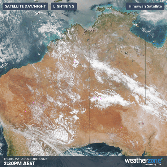
Image: Composite satellite and lightning images from Thursday afternoon, showing widespread thunderstorms across eastern WA, and bushfire smoke across northern Queensland and the eastern NT.
Nearly 400,000 lightning strikes have already been detected from these inland storms since early Thursday, and lots more lightning is on the way in the coming days.
Thunderstorms will continue to develop over the WA interior and western areas of SA on Friday, before spreading further east into SA on Saturday and then deeper into southeastern and eastern Australia on Sunday.
Thunderstorms could become severe over parts of WA, the NT and SA on Friday and Saturday, bringing the risk of heavy rainfall quickly deteriorating road conditions, as well as damaging wind gusts that could disrupt transport routes.
The severe thunderstorm risk will be lower on Sunday as the storms shift their focus further east, although heavy rain remains a risk for parts of Vic, NSW and Qld.
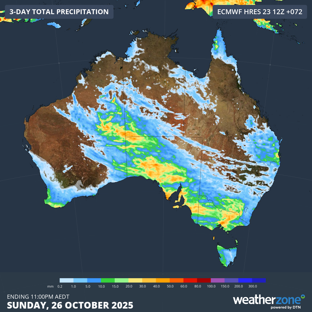
Image: Forecast accumulated rain over the next three days, some of which will fall from thunderstorms.
Satellite images captured on Thursday also revealed large plumes of smoke from a number of active fires burning across northern Qld and the NT.
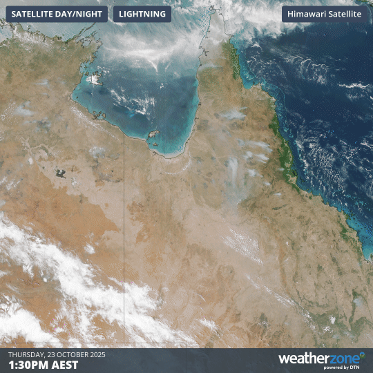
Image: Visible images of bushfire smoke over Qld and the NT on Thursday, October 23, 2025.
As fire services battle to contain already ongoing fires, they will also have to manage intensifying heatwave conditions and worsening fire weather in the coming days. Severe to Extreme heatwave conditions are forecast over parts of Qld, the NT and northern WA over the weekend, with consecutive days reaching the low forties in some areas.
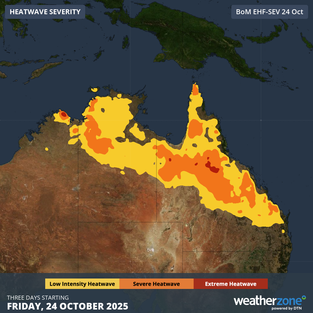
Image: Severe-to-Extreme Heatwave conditions forecast between Friday and Sunday, October 24-26, 2025, parts of Qld, the NT and WA.
Hot, dry and windy conditions will maintain High fire danger ratings across large areas of northern and eastern Australia in the coming days.
A cooling southerly change moving up through NSW on Monday and extending into Queensland on Tuesday will bring cooler temperatures and more manageable conditions next week. This southerly change will however bring a sudden wind change that could cause erratic fire behaviour, potentially worsening fire conditions briefly before they improve.
- Other news
- Fri 24 Oct 2025 Australia's 2025-26 tropical cyclone outlook
- Thu 23 Oct 2025 Australia's west coast shivers while the east coast bakes
- Wed 22 Oct 2025 October temperature records broken in searing Sydney heat
- Wed 22 Oct 2025 Damaging winds in four states as record-challenging heat targets NSW
- Tue 21 Oct 2025 Hottest October day on record in Qld, NSW