News
‹ back to weather news
News
-
Rain and thunderstorms hitting eastern Australia
Ben Domensino, 28 October 2025Widespread rain and thunderstorm activity will affect Queensland and NSW over the next two days, with severe thunderstorms possible in both states.
It has only been two days since a line of violent storms swept across Qld on Sunday, causing large hail, damaging winds and prolific lightning. This included 5 cm hail in some southern suburbs of Brisbane and a 109 km/h wind gust at Gayndah.
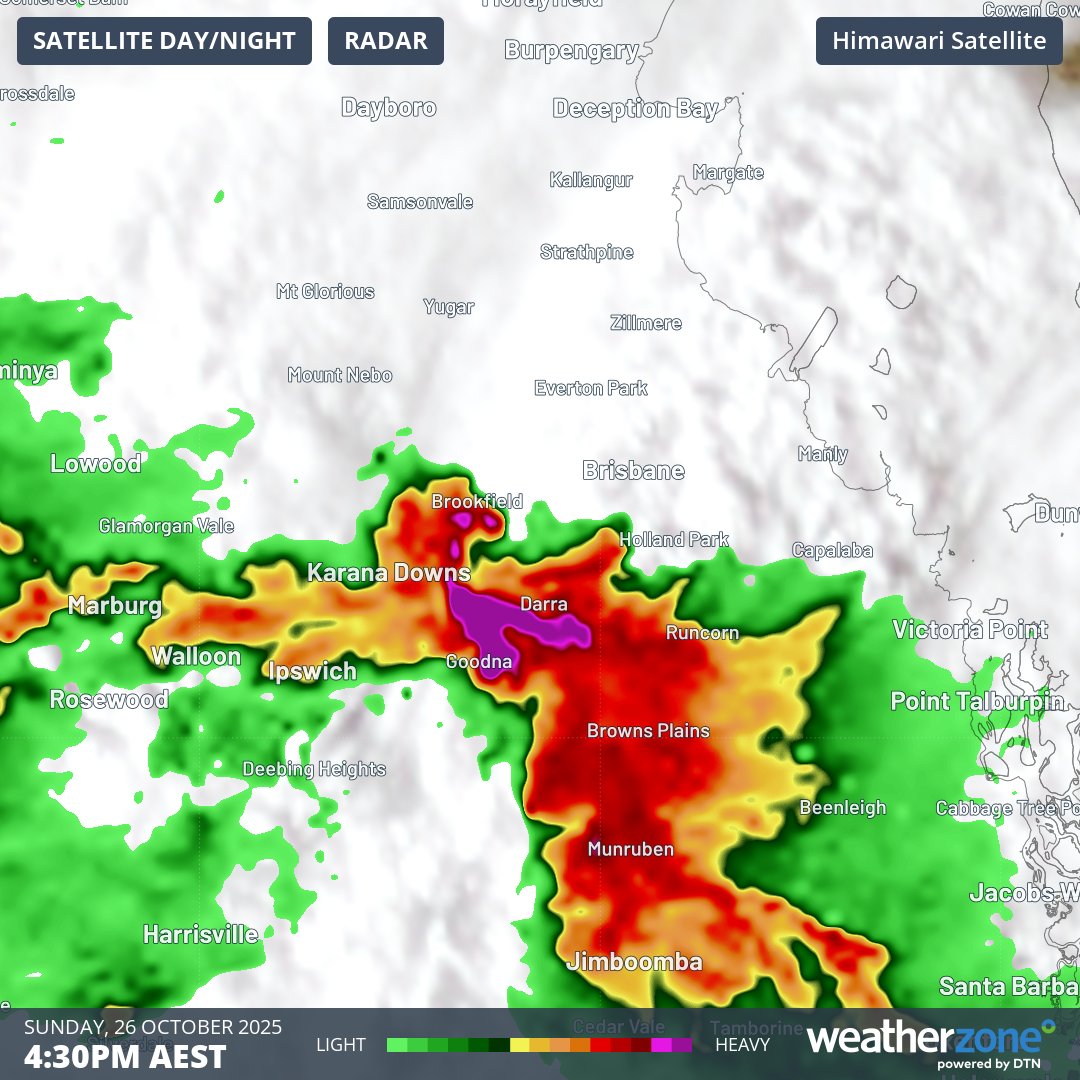
Image: Composite satellite and radar showing a severe thunderstorm to the west of Brisbane on Sunday afternoon. The hook-shaped echo in the radar indicates that this was a rotating supercell thunderstorm.
Sunday’s thunderstorms produced a huge amount of lightning over Qld, with 795,000 strikes detected within an 800 km radius of Emerald during the 24 hours ending at 6am on Monday. Around 77,000 of these strikes, or about 10%, occurred within 100 km of Brisbane.

Image: Lightning in Brisbane on Sunday, October 26, 2025. This is likely a positive lightning strike, which is a rare type of lightning that originates from the top section of a thunderstorm cloud and extends to the ground. Positive lightning accounts for less than 5% of all strikes, and it is typically stronger than most other lightning strikes. Source: @withinblackandwhite / Instagram
Looking ahead, rain and thunderstorms will persist over parts of Qld and NSW on Tuesday and Wednesday as an upper-level trough moves over eastern Australia.
Thunderstorms over the next two days are generally expected to be less intense than the supercells that hit parts of Qld on Sunday. However, severe thunderstorms are still possible in both states, particularly over northern NSW and central Qld on Tuesday, and central eastern Qld again on Wednesday. Rain will also be widespread across the two states, affecting both Brisbane and Sydney.
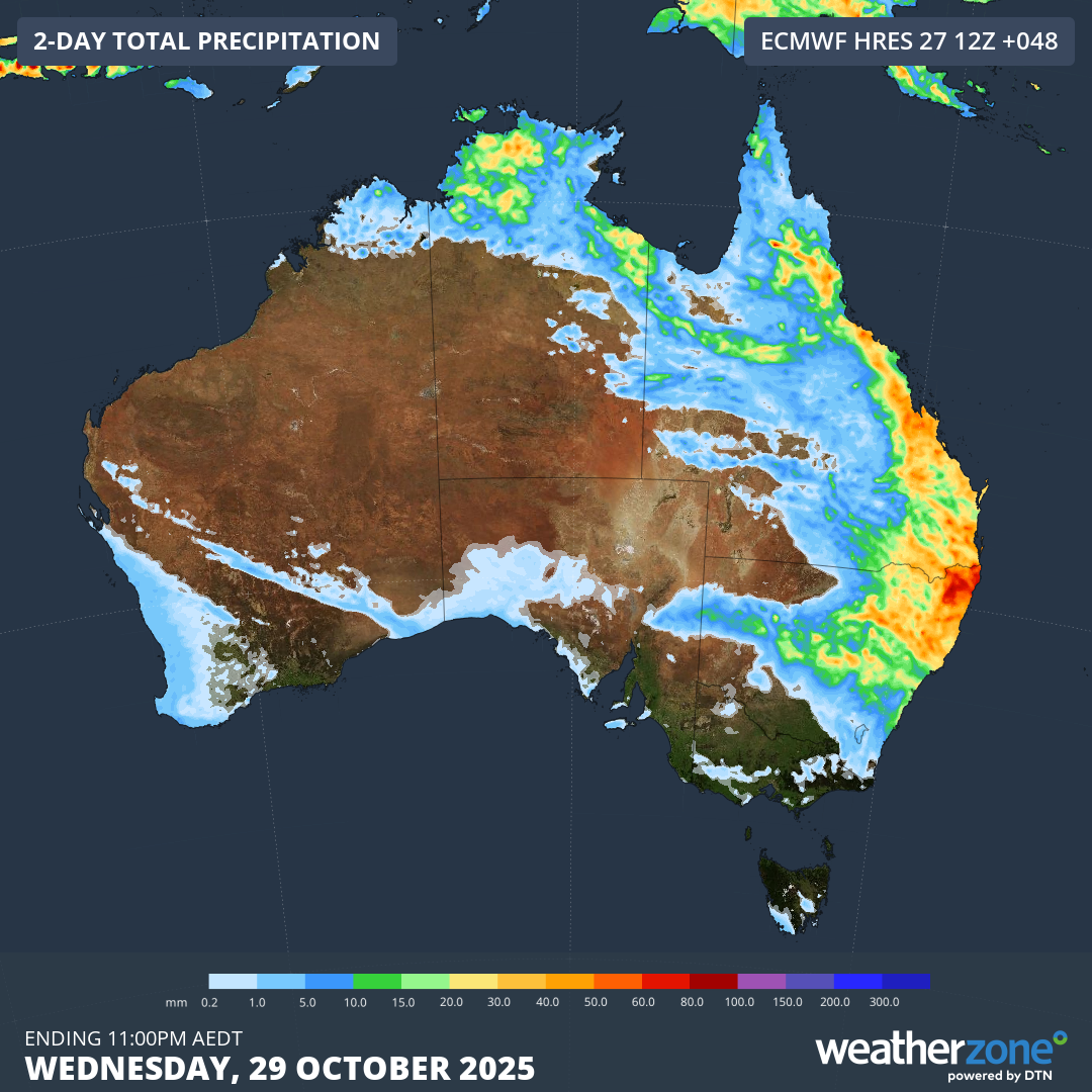
Image: Forecast accumulated rain over Australia during Tuesday and Wednesday combined, showing widespread falls expected across eastern Australia.
Large hail, damaging winds and heavy rain are a risk with severe thunderstorms that develop in the next couple of days. Be sure to check the latest warnings in your area for the most up to date information.
- Other news
- Tue 28 Oct 2025 Sub-zero temperatures in five states, five weeks out from summer
- Mon 27 Oct 2025 Record October heat bakes southeast Qld, northeast NSW
- Mon 27 Oct 2025 Strongest southerly of spring surging up east coast
- Sun 26 Oct 2025 Severe thunderstorms lash three states and two capitals
- Sat 25 Oct 2025 Tropical Storm Melissa set to hook into Jamaica as major hurricane