News
‹ back to weather news
News
-
Erin becomes the first hurricane of the 2025 North Atlantic Season
Angus Konta, 16 August 2025Hurricane Erin located east of the eastern Caribbean islands, has being slowly gathering strength in the last few days as it tracks west through the tropical North Atlantic Ocean. Now it has become the first hurricane in the North Atlantic Ocean for the 2025 season.
According to the National Hurricane Centre (NHC), as of Friday afternoon local time, Erin has recorded maximum sustained winds of 65 knots (about 120km/h). This is just above the threshold required to become a category 1 hurricane, and equivalent to a category 3 tropical cyclone over Australian and South Pacific waters.
This timing of this system lines up with the beginning of the peak of hurricane season for the North Atlantic, where on average, 4-5 hurricanes form between August and October, in addition to 8-10 named tropical storms during the same period.
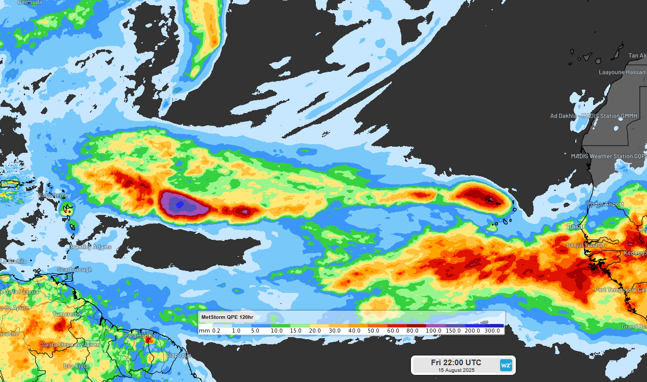
Image: MetStorm estimated accumulated rainfall for 120h across the Atlantic Ocean. Higher accumulations across the centre of the image are associated with Hurricane Erin as it developed. Source - Weatherzone
In its early life as a tropical disturbance, Erin caused significant flooding for Cabo Verde, an island nation not far west of Africa (at the centre right of the above image). Now on the other side of the Atlantic, Erin is threatening a number of nations of the eastern Caribbean with damaging winds, heavy rainfall and damaging surf. At this stage, the NHC is predicting up to 150mm of rainfall, and a 10-30% chance of tropical storm force winds (exceeeding 34 knots or 63km/h) for the islands in this area by Sunday morning local time.
In the coming days, Erin is expected to intensify rapidly, possibly becoming a major hurricane as early as Saturday night local time, while curving away from the Caribbean, which will no doubt be good news for residents and tourists alike. Despite this, some impacts are still likely for north and east coasts of some islands, including Puerto Rico and the Bahamas, and later in the week for Bermuda.
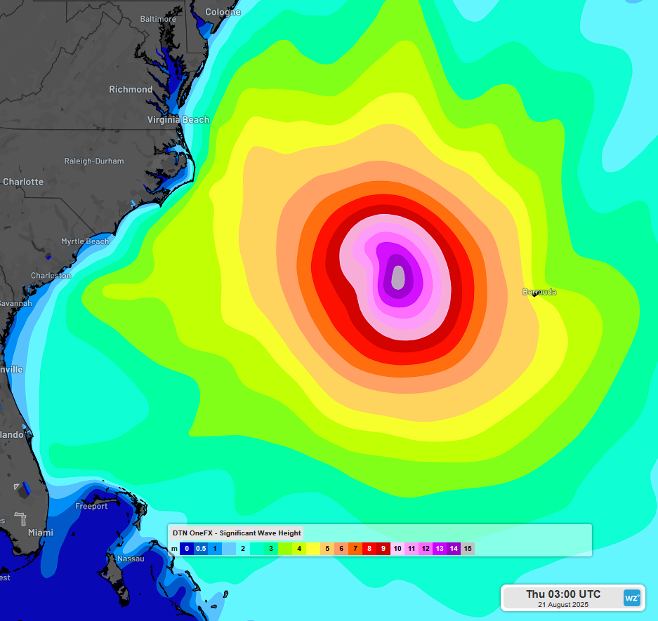
Image: DTN 1FX significant wave height forecast for Wednesday night local time. Source - Weatherzone
As for the mainland US, Hurricane Erin is expected to track roughly parallel to the coast, and is unlikely to bring direct impacts. However, very large and possibly damaging surf is expected up and down the exposed Atlantic coast, particularly for North Carolina where waves may reach as much as 16ft (5m) in the middle of next week.
If you want to keep track of the latest information regarding the development of Erin, you can visit the NHC webpage.
- Other news
- Fri 15 Aug 2025 First extreme fire danger rating of the season for Darwin
- Fri 15 Aug 2025 More rain to soak eastern Australia next week
- Thu 14 Aug 2025 Significant weekend snowfalls to boost Aussie ski season
- Thu 14 Aug 2025 Winter storms to hit eastern Australia on Thursday
- Wed 13 Aug 2025 Perth approaching winter rainfall streak not seen in 3 decades