News
‹ back to weather news
News
-
Perth's wettest day in more than a year
Anthony Sharwood, 28 July 2025Significant rain has fallen across the southwest of WA, with Perth recording 41mm in the 24 hours to 9am Monday, making it the city's wettest day in just over a year.
This latest soaking means that Perth has now exceeded its average monthly rainfall, with 174.2mm in the gauge for July 2025 to date, compared to the average of 147mm.
In good news for the city’s parks, gardens and water storages, Perth has exceeded its monthly rainfall average in both June and July this winter, after the previous nine months all saw below-average totals.
Meanwhile similarly heavy falls occurred at numerous coastal locations across the South West Land Division, with totals topping out closer to 10mm further inland in the Central Wheat Belt and Great Southern forecast districts.
Noteworthy 24-hour rainfall totals included:
- 76mm at Cowaramup (near Margaret River).
- 54mm at Swanbourne (a coastal Perth suburb), the highest reading in the Perth metro area and the site’s highest daily fall in any month for two years.
- 52.8mm at Gingin Airport (about an hour north of the Perth CBD) which was the site’s highest daily fall in any month in six years.
- 41mm at the official Perth weather station in the CBD, the highest fall since July 18, 2024, when 44mm was recorded.
- 29mm At Jurien Bay (about halfway up the coast between Perth and Geraldton) which brought the town’s running July tally to a healthy 196.6mm, nearly doubling the monthly average of 110.5mm.
This was an event during which rain fell steadily across most of the areas mentioned from Sunday morning into Monday morning, as a cold front and associated low pressure system crossed the southwest.
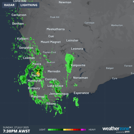
Image: Eight-hour radar loop showing a sustained period of heavy rainfall across southwest WA overnight, from 7:30pm Sunday to 3:30am Monday (AWST).
The cold front is now moving east, with showers persisting in coastal districts. A drying trend will set in from later today through much of the working week across the southwest, before another front moves in over the weekend, promising more significant rainfall.
It’s also worth noting that the airmass over southwest WA is very cold in the wake of the front, with Perth heading for a Monday maximum of just 14°C. The city’s coldest day of 2025 to date was last Thursday, July 24, when the mercury peaked at exactly 14°C.
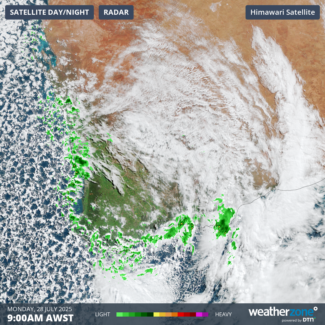
Image: Combined radar and satellite image at 9am (AWST) on Monday, July 28, 2025, showing the tell-tale speckled cloud pattern typically associated with frigid airmasses with polar origins.
Several towns in WA's South West forecast district were hovering between just 5°C and 6°C at 9am on Monday.
- Other news
- Mon 28 Jul 2025 Cold week ahead for Australia with rain looming for east coast
- Sun 27 Jul 2025 Severe thunderstorms strike WA’s southwest ahead of subpolar air mass
- Sat 26 Jul 2025 Colossal low pressure system grips eastern Australia
- Fri 25 Jul 2025 Rainband spreading across Australia – here's what to expect this weekend
- Fri 25 Jul 2025 Polar blast sends shivers across WA