News
‹ back to weather news
News
-
Polar blast to deliver long weekend snow in Aussie Alps
Ben Domensino, 3 June 2025The opening of the 2025 ski season will feature several days of fresh snow as two cold fronts surge across southeastern Australia during the King’s Birthday long weekend.
The June long weekend typically marks the official start of the ski season for most of Australia's main ski resorts. However, early June is notoriously fickle for Australian snow and some seasons don’t have enough snow on the ground to allow resorts to open this early in the month.
Fortunately, Mother Nature will be kindly serving up several bursts of cold weather over the coming week, including a good bout of fresh natural snow over the long weekend and early next week.
The middle of this week will see a weak cold front sliding across southeastern Australia, delivering some light snow to the high mountains in NSW, Tas and Vic. The satellite images below show this front moving over Vic on Tuesday morning. The huge field of speckled cloud to the south of this front reveals a large cold air mass surging towards southeastern Australia.
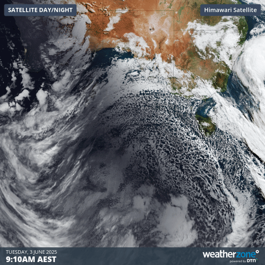
Image: Visible satellite images showing clouds to the south of Australia on Tuesday morning.
While Tuesday’s front won’t deliver a lot of natural snow, it will cause temperatures to drop and allow ski resorts to make plenty of artificial snow in the lead-up to the weekend. Wednesday night and Thursday morning will be particularly cold, with minimum temperatures forecast to reach -5 to -7°C in the Vic and NSW Alps.
Two cold fronts are set to sweep across southeastern Australia this weekend, one on Saturday and another on Sunday. This pair of fronts will bring plenty of cold air and should see snow falling in the mountains each day from Saturday to at least Tuesday.
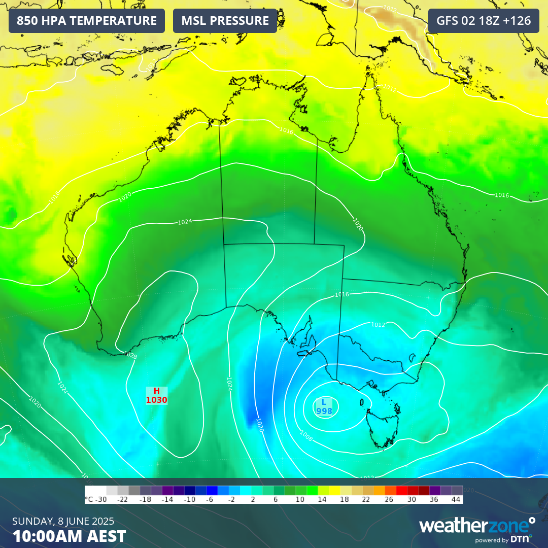
Image: Modelled 850 hPa temperature and mean sea level pressure (MSLP) showing cold air being driven over southeastern Australia on Sunday, June 8, 2025.
It’s still too early to predict exactly how much snow will fall from these systems, although computer models suggest that about 20 to 50 cm could fall across this four-day period. This range could shift up or down in the lead-up to the long weekend as new computer model data becomes available.
Weatherzone’s Snow and Ski Forecast page will be updated every day throughout the 2025 ski season, featuring forecast summaries written by meteorologists, a 14-day snow forecast and live resort cameras.
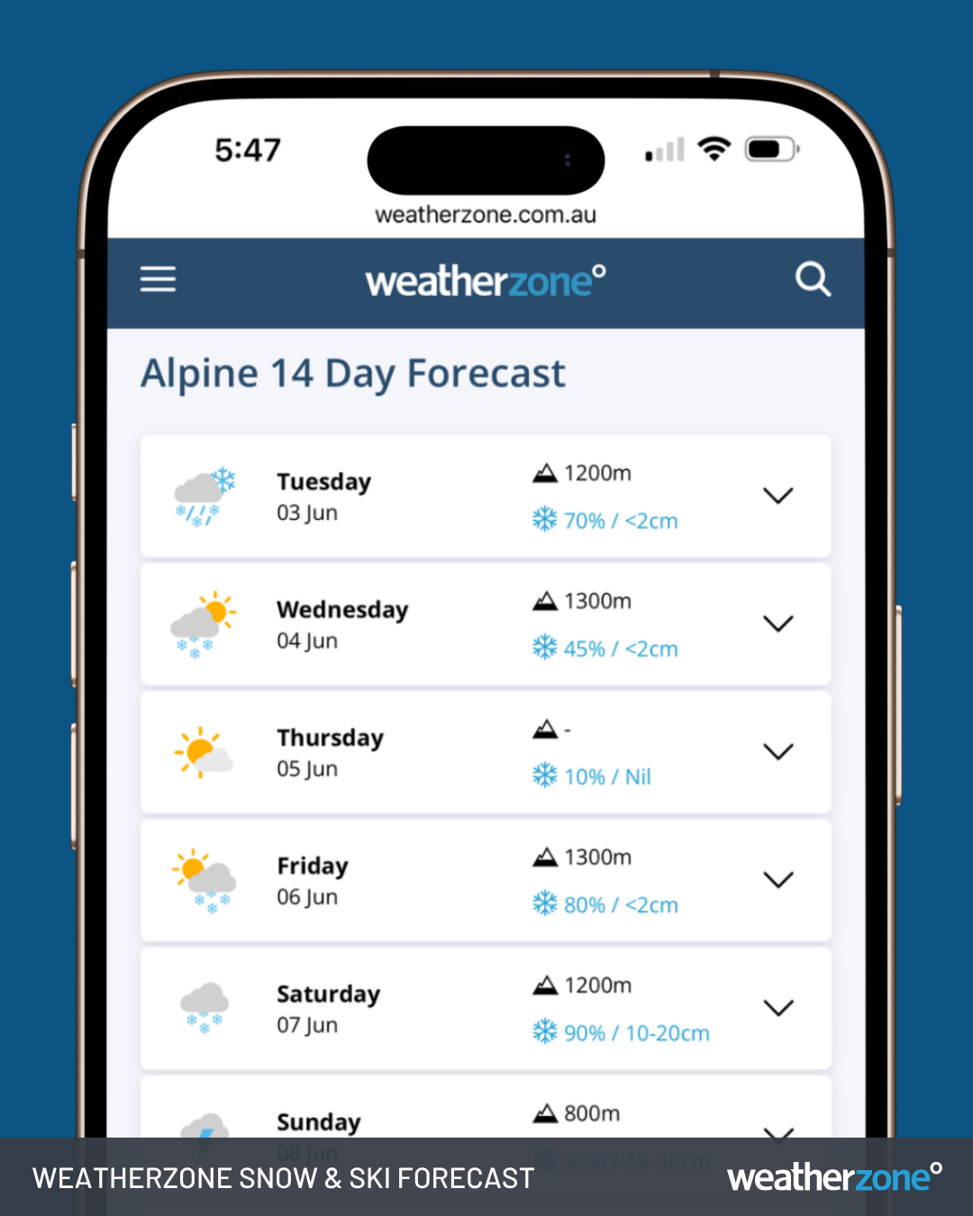
Image: Snow and ski forecast on the Weatherzone app.
- Other news
- Thu 05 Jun 2025 A welcome week of showers for Adelaide, Melbourne, Hobart
- Thu 05 Jun 2025 Coldest morning in years for parts of SE Australia
- Wed 04 Jun 2025 Powerful storms lash New Caledonia and South Pacific
- Wed 04 Jun 2025 Perth's wettest day in 11 months, more rain on the way
- Wed 04 Jun 2025 Sydney's coldest day of the year