News
‹ back to weather news
News
-
Big wintry week of rain, snow and frost for southern Australia
Anthony Sharwood, 2 June 2025Heavy rain will fall in southwestern WA, while two significant cold systems will send a deep chill, rain and snow across Tasmania and southeastern mainland Australia, in an unmistakeable sign that winter is now here.
Southwest WA
Perth appears set for its heaviest rain of 2025 to date beginning later this Monday and extending through to Wednesday. As a relatively slow-moving low pressure system approaches from the west, rainfall totals could exceed 50mm across those three days.
Locals will welcome the wet spell after an extremely dry start to the year. All five months of 2025 this far have seen below-average rainfall in Perth – and that includes May even though more than 50mm fell in total in the last eight days of the month.
While the southwest will be soggy, it won’t be particularly chilly, with the cold front on the back of the low sliding south of Cape Leeuwin (the continent's southwesterly tip).
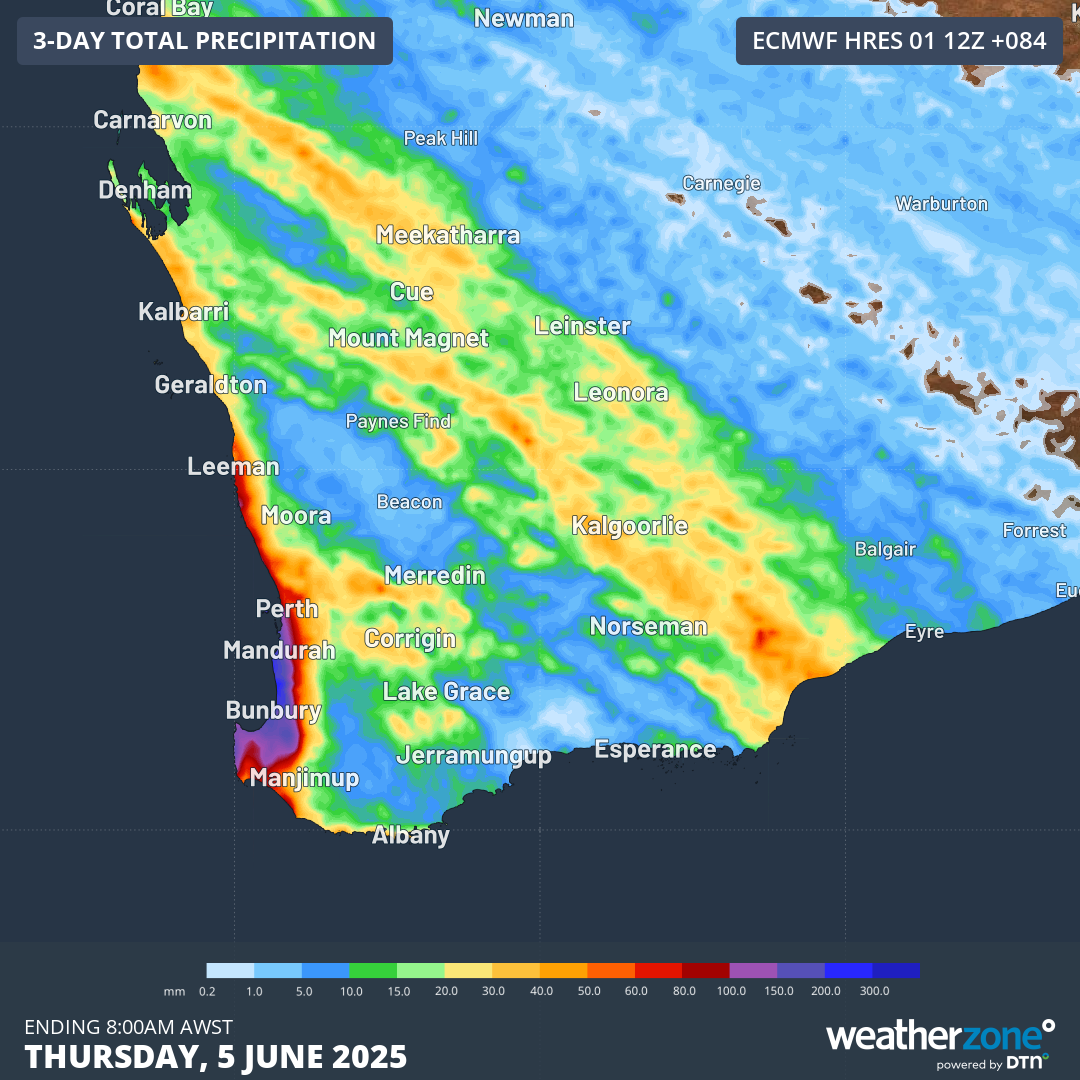
Image: Accumulated rainfall across Australia’s SW corner to 8am Thursday, June 5, 2025, according to the ECMWF model.
Southeast Australia system 1: A big chill on Tuesday/Wednesday/Thursday
The first cold outbreak due across the southeast this week will come via a cold front which will clip the easternmost part of the continent as it makes a beeline northwards.
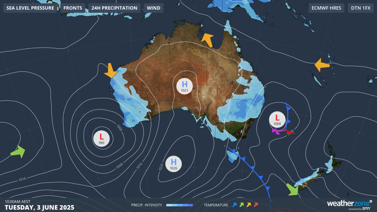
Image: Synoptic chart for Tuesday, June 3, 2025.
The coldest maximums of the year so far are likely at many locations on Tuesday or Wednesday (or in some cases both) in the cold southwesterly airflow, while a low off northern NSW will bring showers to northeastern NSW, possibly extending into southeast Qld.
For the mainland alpine areas, a few centimetres of snow could accumulate ahead of the coming weekend’s official season opening, but the main effect of this system will be several nights of very cold, clear nights ideal for snowmaking in the wake of the front.
Heavy snowfalls that could really kick-start the season into action look much more likely from the second system due over the weekend – as well as even colder maximums across the southeast.
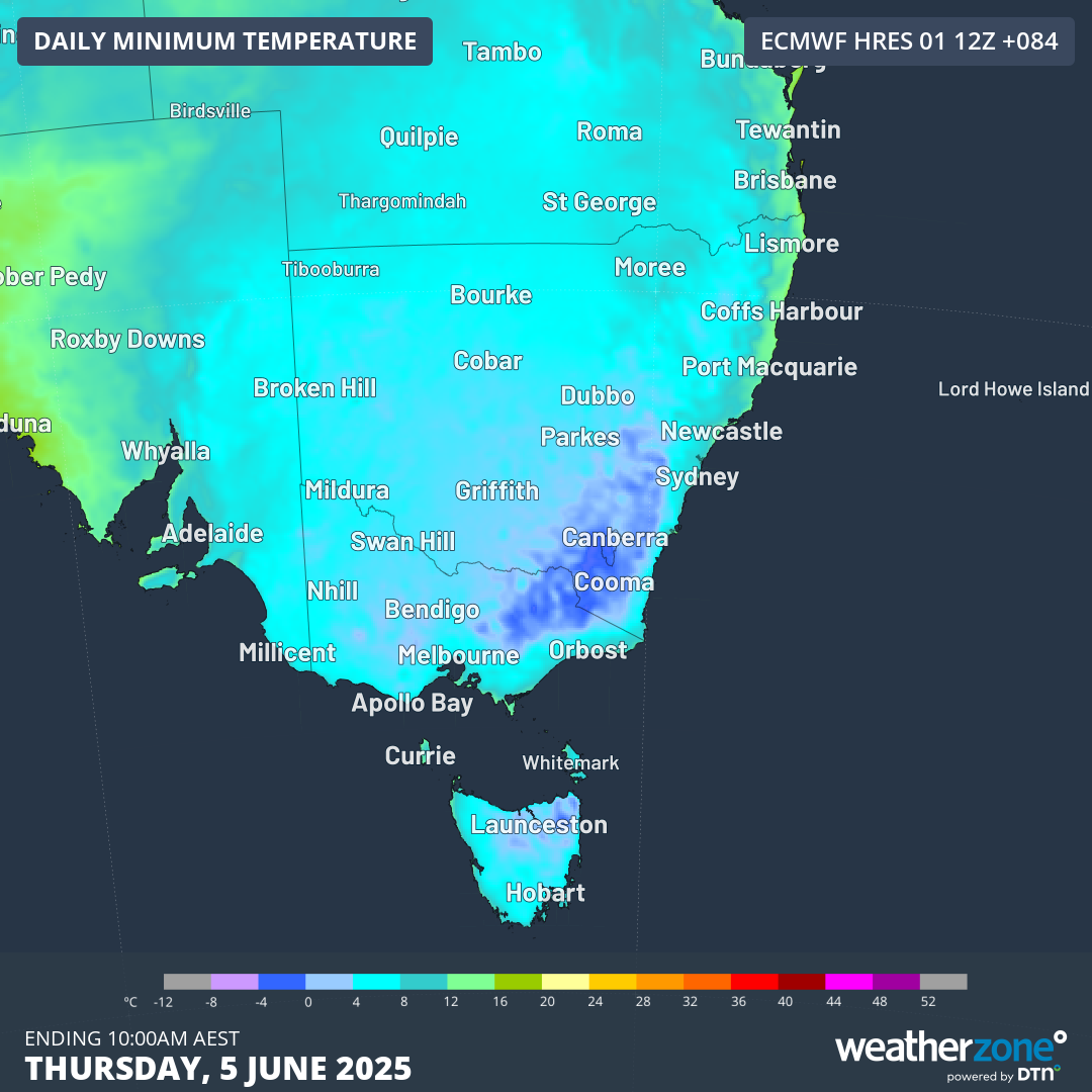
Image: Minimum temperatures across SE Australia for Thursday, June 5, according to the ECMWF model.
Southeast Australia system 2: Potentially heavy snowfalls this coming weekend
Towards the end of this week, a polar airmass is expected to surge towards southeastern Australia, accompanied by plentiful moisture.
This system will be a double punch, with the first cold front likely to bring snow to only the highest parts of the mainland alpine region above about 1700m on Saturday. Later on Sunday into Monday, a more significant cold outbreak is looming.
The low pressure system and associated cold front are expected to form what’s called a cut-off low, which means a pool of cold air gets cut off from the band of westerlies that circulates south of Australia in the mid-latitudes.
At present, the cold pool is projected to park itself right over the southeast, which could mean heavy snowfalls lasting two days or longer for the alpine region – with snow possible at lower elevations on Monday as the coldest air arrives.
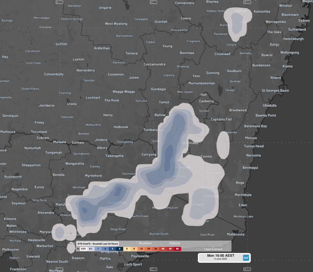
Image: Early modelling suggests widespread snow accumulation on the mainland alpine region as well as across nearby elevated areas. Note that one inch equals approx. 2.5cm.
A word of caution for snow lovers: these sorts of systems can be hit and miss.
When a classic cold front embedded in the westerly stream sweeps across the SE mainland, you can reliably expect frequent widespread showers with snowfalls in the mountains. Cut-off lows are less predictable.
So it’s still very much a wait-and-see with the system which is still nearly a week away. But current indications are that the opening weekend of the 2025 ski season could see persistent snowfalls that lay down a good base of snow for the season ahead.
READ MORE: What is a cut-off low and why do they matter?
For the latest snow forecasts, live cam images and much more throughout the 2025 snow season, don’t forget to bookmark Weatherzone’s snow page.
- Other news
- Thu 05 Jun 2025 A welcome week of showers for Adelaide, Melbourne, Hobart
- Thu 05 Jun 2025 Coldest morning in years for parts of SE Australia
- Wed 04 Jun 2025 Powerful storms lash New Caledonia and South Pacific
- Wed 04 Jun 2025 Perth's wettest day in 11 months, more rain on the way
- Wed 04 Jun 2025 Sydney's coldest day of the year