Forecast
-
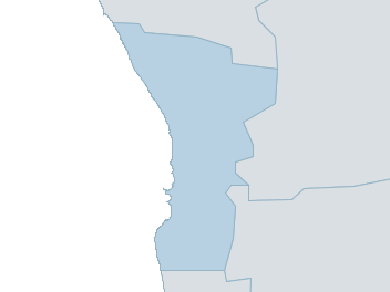
Map
lower west Weather Forecast
For WednesdayDistrict Forecast

Wednesday Partly cloudy. Medium chance of showers, becoming less likely in the evening. The chance of a thunderstorm, possibly severe with damaging winds, large hail and heavy rain which may lead to flash flooding. Winds E/SE 20 to 30 km/h. Daytime maximum temperatures around 30. 
Thursday Partly cloudy. Slight chance of a shower, most likely in the afternoon. The chance of a thunderstorm in the morning and afternoon, possibly severe with heavy rain which may lead to flash flooding. Winds E 25 to 35 km/h tending SE/SW 15 to 20 km/h in the middle of the day then tending E/SE in the late evening. Overnight temperatures falling to around 16 with daytime temperatures reaching the mid to high 20s. 
Friday Partly cloudy. Slight chance of a shower. The chance of a thunderstorm in the afternoon. Winds E/SE 15 to 20 km/h turning S/SW 15 to 25 km/h during the morning then becoming light during the evening. Overnight temperatures falling to around 14 with daytime temperatures reaching the mid to high 20s. Saturday Partly cloudy. Medium chance of showers. Light winds becoming W/SW 25 to 35 km/h during the morning. Overnight temperatures falling to between 13 and 16 with daytime temperatures reaching the mid to high 20s. -
National Forecast
-
weather_m_banner_320x50
-
Sydney: Mobile Map (33.8671°S, 151.2071°E, 74m AMSL) set your location ›
lower west Weather Forecast
For WednesdayDistrict Forecast
Wednesday Partly cloudy. Medium chance of showers, becoming less likely in the evening. The chance of a thunderstorm, possibly severe with damaging winds, large hail and heavy rain which may lead to flash flooding. Winds E/SE 20 to 30 km/h. Daytime maximum temperatures around 30. Thursday Partly cloudy. Slight chance of a shower, most likely in the afternoon. The chance of a thunderstorm in the morning and afternoon, possibly severe with heavy rain which may lead to flash flooding. Winds E 25 to 35 km/h tending SE/SW 15 to 20 km/h in the middle of the day then tending E/SE in the late evening. Overnight temperatures falling to around 16 with daytime temperatures reaching the mid to high 20s. Friday Partly cloudy. Slight chance of a shower. The chance of a thunderstorm in the afternoon. Winds E/SE 15 to 20 km/h turning S/SW 15 to 25 km/h during the morning then becoming light during the evening. Overnight temperatures falling to around 14 with daytime temperatures reaching the mid to high 20s. Saturday Partly cloudy. Medium chance of showers. Light winds becoming W/SW 25 to 35 km/h during the morning. Overnight temperatures falling to between 13 and 16 with daytime temperatures reaching the mid to high 20s.