Forecast
-
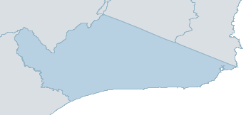
Map
east gippsland Weather Forecast
For MondayDistrict Forecast

Saturday Becoming cloudy. Very high chance of showers, most likely in the late afternoon and evening. Snow falling above 900 metres. The chance of a thunderstorm in the W in the afternoon and evening. Possible small hail in the SW in the evening. Winds N/NW 15 to 25 km/h turning W/SW in the late afternoon. Daytime maximum temperatures between 9 and 17. Sunday Cloudy. High chance of showers, most likely from the late morning. Snow falling above 600 metres. The chance of a thunderstorm near the coast. Possible small hail. Winds W 20 to 30 km/h turning SW 25 to 35 km/h in the middle of the day. Overnight temperatures falling to between minus 3 and 5 above zero with daytime temperatures reaching between 3 and 11. 
Monday Partly cloudy. High chance of showers, with possible small hail in the S. Snow falling above 700 metres. Winds W/SW 15 to 25 km/h. Overnight temperatures falling to between minus 2 and 6 above zero with daytime temperatures reaching between 4 and 12. Tuesday Cloudy. High chance of showers in the E, medium chance elsewhere. Snow falling above 900 metres. Possible small hail in the far E. Winds NW/SW 15 to 20 km/h tending S/SW 15 to 25 km/h during the morning. Overnight temperatures falling to between minus 1 and 6 above zero with daytime temperatures reaching between 5 and 13. -
National Forecast
-
weather_m_banner_320x50
-
Sydney: Mobile Map (33.8671°S, 151.2071°E, 74m AMSL) set your location ›
east gippsland Weather Forecast
For MondayDistrict Forecast
Saturday Becoming cloudy. Very high chance of showers, most likely in the late afternoon and evening. Snow falling above 900 metres. The chance of a thunderstorm in the W in the afternoon and evening. Possible small hail in the SW in the evening. Winds N/NW 15 to 25 km/h turning W/SW in the late afternoon. Daytime maximum temperatures between 9 and 17. Sunday Cloudy. High chance of showers, most likely from the late morning. Snow falling above 600 metres. The chance of a thunderstorm near the coast. Possible small hail. Winds W 20 to 30 km/h turning SW 25 to 35 km/h in the middle of the day. Overnight temperatures falling to between minus 3 and 5 above zero with daytime temperatures reaching between 3 and 11. Monday Partly cloudy. High chance of showers, with possible small hail in the S. Snow falling above 700 metres. Winds W/SW 15 to 25 km/h. Overnight temperatures falling to between minus 2 and 6 above zero with daytime temperatures reaching between 4 and 12. Tuesday Cloudy. High chance of showers in the E, medium chance elsewhere. Snow falling above 900 metres. Possible small hail in the far E. Winds NW/SW 15 to 20 km/h tending S/SW 15 to 25 km/h during the morning. Overnight temperatures falling to between minus 1 and 6 above zero with daytime temperatures reaching between 5 and 13.