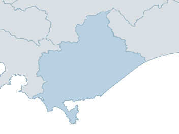
You do not have a default location set
To set your location please use the search box to find your location and then click "set as my default location" on the local weather page.

Forecast

  1. Map

    w s gippsland Weather Forecast

    For Wednesday

    District Forecast

    Sunny Wednesday
    Mostly clear. Winds W 15 to 20 km/h becoming light in the evening.
    Showers Thursday
    Mostly sunny. The chance of morning frost about the ranges. The chance of morning fog. Medium chance of showers near Wilsons Promontory in the morning. Near zero chance of rain elsewhere. Light winds. Overnight temperatures falling to between 3 and 7 with daytime temperatures reaching between 16 and 19.
    Possible shower Friday
    Partly cloudy. The chance of fog in the early morning. Very high chance of showers, most likely from the late morning. Snow falling above 1300 metres. Winds W/NW 15 to 20 km/h turning SW 25 to 35 km/h in the early afternoon. Overnight temperatures falling to between 4 and 8 with daytime temperatures reaching between 13 and 18.
    Showers Saturday
    Partly cloudy. Slight chance of a shower about the ranges in the morning. Near zero chance of rain elsewhere. Snow possible above 1200 metres. Winds S/SW 20 to 30 km/h becoming light during the day. Overnight temperatures falling to between 2 and 6 with daytime temperatures reaching between 8 and 14.
  2. National Forecast

  3. weather_m_banner_320x50

  4. Sydney: Mobile Map (33.8671°S, 151.2071°E, 74m AMSL) set your location ›

    w s gippsland Weather Forecast

    For Wednesday

    District Forecast

    Sunny Wednesday
    Mostly clear. Winds W 15 to 20 km/h becoming light in the evening.
    Showers Thursday
    Mostly sunny. The chance of morning frost about the ranges. The chance of morning fog. Medium chance of showers near Wilsons Promontory in the morning. Near zero chance of rain elsewhere. Light winds. Overnight temperatures falling to between 3 and 7 with daytime temperatures reaching between 16 and 19.
    Possible shower Friday
    Partly cloudy. The chance of fog in the early morning. Very high chance of showers, most likely from the late morning. Snow falling above 1300 metres. Winds W/NW 15 to 20 km/h turning SW 25 to 35 km/h in the early afternoon. Overnight temperatures falling to between 4 and 8 with daytime temperatures reaching between 13 and 18.
    Showers Saturday
    Partly cloudy. Slight chance of a shower about the ranges in the morning. Near zero chance of rain elsewhere. Snow possible above 1200 metres. Winds S/SW 20 to 30 km/h becoming light during the day. Overnight temperatures falling to between 2 and 6 with daytime temperatures reaching between 8 and 14.