Forecast
-
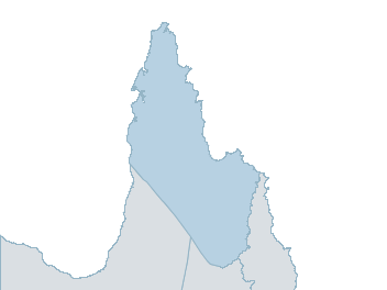
Map
peninsula Weather Forecast
For TuesdayDistrict Forecast

Monday Partly cloudy. Slight chance of a shower near the E coast, near zero chance elsewhere. Winds E/SE 25 to 35 km/h. Daytime maximum temperatures in the low 30s. 
Tuesday Partly cloudy. Slight chance of a shower near the E coast. Winds E/SE 25 to 35 km/h. Overnight temperatures falling to the low to mid 20s with daytime temperatures reaching the low 30s. Wednesday Partly cloudy. Slight chance of a shower N of Coen, most likely in the morning and afternoon. Winds SE 25 to 35 km/h. Overnight temperatures falling to the low to mid 20s with daytime temperatures reaching the low to mid 30s. Thursday Partly cloudy. Medium chance of showers N of Coen, most likely in the morning and afternoon. Winds SE 15 to 20 km/h tending E/SE 25 to 40 km/h during the morning. Overnight temperatures falling to the low to mid 20s with daytime temperatures reaching around 30. -
National Forecast
-
weather_m_banner_320x50
-
Sydney: Mobile Map (33.8671°S, 151.2071°E, 74m AMSL) set your location ›
peninsula Weather Forecast
For TuesdayDistrict Forecast
Monday Partly cloudy. Slight chance of a shower near the E coast, near zero chance elsewhere. Winds E/SE 25 to 35 km/h. Daytime maximum temperatures in the low 30s. Tuesday Partly cloudy. Slight chance of a shower near the E coast. Winds E/SE 25 to 35 km/h. Overnight temperatures falling to the low to mid 20s with daytime temperatures reaching the low 30s. Wednesday Partly cloudy. Slight chance of a shower N of Coen, most likely in the morning and afternoon. Winds SE 25 to 35 km/h. Overnight temperatures falling to the low to mid 20s with daytime temperatures reaching the low to mid 30s. Thursday Partly cloudy. Medium chance of showers N of Coen, most likely in the morning and afternoon. Winds SE 15 to 20 km/h tending E/SE 25 to 40 km/h during the morning. Overnight temperatures falling to the low to mid 20s with daytime temperatures reaching around 30.