Forecast
-
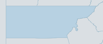
Map
upper western Weather Forecast
For MondayDistrict Forecast

Monday Partly cloudy. Slight chance of a shower in the SE, near zero chance elsewhere. Winds SE/SW 15 to 25 km/h. 
Tuesday Partly cloudy. Medium chance of showers in the E, most likely in the late morning and afternoon. Near zero chance of rain elsewhere. The chance of a thunderstorm in the morning and afternoon. Winds S/SE 25 to 40 km/h. Overnight temperatures falling to between 12 and 16 with daytime temperatures reaching 23 to 29. 
Wednesday Mostly sunny. Slight chance of a shower. Winds SE 15 to 25 km/h. Overnight temperatures falling to between 9 and 14 with daytime temperatures reaching the low to high 20s. Thursday Partly cloudy. Medium chance of showers in the W, slight chance elsewhere. The chance of a thunderstorm. Winds E/SE 15 to 25 km/h. Overnight temperatures falling to between 11 and 15 with daytime temperatures reaching 21 to 26. -
National Forecast
-
weather_m_banner_320x50
-
Sydney: Mobile Map (33.8671°S, 151.2071°E, 74m AMSL) set your location ›
upper western Weather Forecast
For MondayDistrict Forecast
Monday Partly cloudy. Slight chance of a shower in the SE, near zero chance elsewhere. Winds SE/SW 15 to 25 km/h. Tuesday Partly cloudy. Medium chance of showers in the E, most likely in the late morning and afternoon. Near zero chance of rain elsewhere. The chance of a thunderstorm in the morning and afternoon. Winds S/SE 25 to 40 km/h. Overnight temperatures falling to between 12 and 16 with daytime temperatures reaching 23 to 29. Wednesday Mostly sunny. Slight chance of a shower. Winds SE 15 to 25 km/h. Overnight temperatures falling to between 9 and 14 with daytime temperatures reaching the low to high 20s. Thursday Partly cloudy. Medium chance of showers in the W, slight chance elsewhere. The chance of a thunderstorm. Winds E/SE 15 to 25 km/h. Overnight temperatures falling to between 11 and 15 with daytime temperatures reaching 21 to 26.